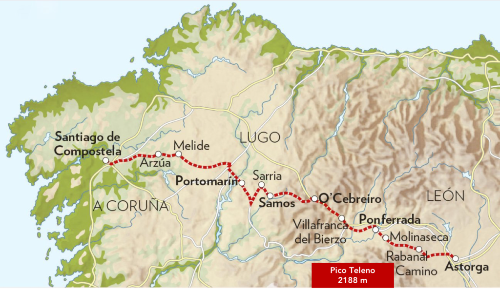
Villafranca del Bierzo, the gateway to Galicia
DIDIER HEUMANN, ANDREAS PAPASAVVAS

We divided the course into several sections to make it easier to see. For each section, the maps show the course, the slopes found on the course, and the state of the Camino. The courses were drawn on the “Wikilocs” platform. Today, it is no longer necessary to walk around with detailed maps in your pocket or bag. If you have a mobile phone or tablet, you can easily follow routes live.
For this stage, here is the link:
https://fr.wikiloc.com/itineraires-randonnee/de-ponferrada-a-villafranca-del-bierzo-par-le-camino-frances-43293328
It is obviously not the case for all pilgrims to be comfortable with reading GPS and routes on a laptop, and there are still many places in Europe without an Internet connection. Therefore, you will find soon a book on Amazon that deals with this course.
If you only want to consult lodging of the stage, go directly to the bottom of the page.
On the way, you will pass Cacabelos. This small town once had a prominent position in the early historical times of Bierzo. The oldest trace of the Cacabelos settlement dates back to the Paleolithic, but the most serious traces are associated with Celtic culture, before the arrival of the Romans in Bierzo. There were castros here, namely forts, including the Castro Ventosa, with remains still visible on a hill southwest of Cacabelos. But the most abundant archaeological remains are from the Roman period. The Roman wars against the Asturians and Galicians ended with the capture of Castro Ventosa, believed to be the site of the Celtic city named Bergidum, believed to be the birthplace of Bierzo. Later, the Romans settled on the current site of Cacabelos, which the Romans called Bergida or Bergidum Flavium. It was an important Roman place, which became the administrative center of the many gold deposits that the Romans exploited in Astorga and in Bierzo. This place is located at the height of the current cemetery of Cacabelos.
With the disappearance of the Roman Empire, in the Vth century, the Suevi (Swabians) took over the country. Later, in the VIth century, the Visigoths, who established a Visigothic colony on the site of Bergida, annexed the territory. The site did not disappear with the Muslim invasion at the beginning of the VIIIth century, although its name disappeared. From then on, the site was called Ventosa, a name that survived into the IXth century and the beginning of the Xth century, continuing to serve as the capital of Bierzo until its total depopulation and the destruction of its walls in the XIIIth century. Later, Cacabelos returned to anonymity in relation to Molinaseca and Villafranca del Bierzo.
Your crossing of the Bierzo will end at Villafranca del Bierzo. Although there is archaeological evidence of a settlement that was already important in pre-Roman and Roman times, Villafranca del Bierzo would have been founded by French monks of the order of Cluny in the early XIth century. They built a monastery here called el Monasterio de Santa María de Cluniaco, in order to meet the needs of the many pilgrims who passed through. This place was the antechamber to the narrow valley of the Río Valcarce, which takes you to Galicia. The French monks and French pilgrims who stayed here gave the village the name Villa francorum (city of the French), which gave way to the Spanish version Villafranca. For several centuries, there were two magistrates in the city: one for the Franks and one for the rest of the city.
The crossing of the Bierzo is not really exciting. There is a lot of road between the small towns that follow each other. Fortunately, it is also a wine and fruit region. The vineyard developed well after the crises caused by phylloxera. You will therefore find many bodegas and a wine cooperative on the route.
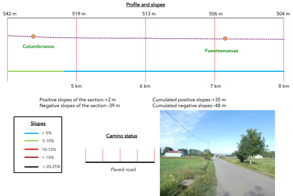
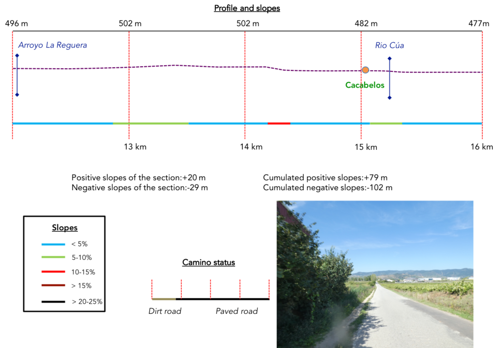
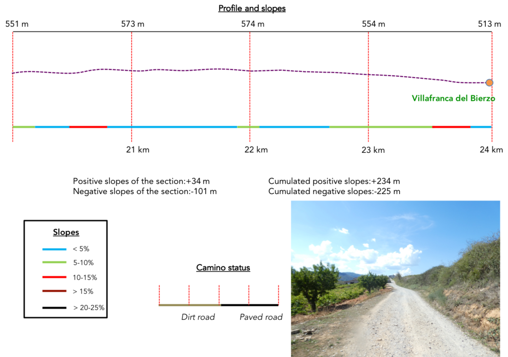
Difficulty of the course: Slope variations (+235 meters /-224 meters) are very gentle today. It’s a long way in the plain, with sometimes-gentle hills at the end of the stage.
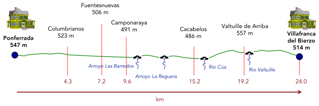
Today is a rare stage of the Camino francés where you will spend a lot of time on tarmac. Beyond León, many passages on the roads can be practiced on a strip of dirt, more or less wide along the road, but here, it is rather the road:
- Paved roads: 16.9 km
- Dirt roads: 7.1 km
We did the route from León in the fall, in fairly good weather, unlike the first part of the route, which was done on soggy ground, mostly in sticky mud.
It is very difficult to specify with certainty the incline of the slopes, whatever the system you use.
For “real slopes” reread the mileage manual on the home page.

Section 1: Leaving Ponferrada.
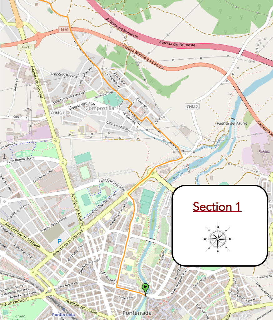
General overview of the difficulties of the route: course without any difficulty.
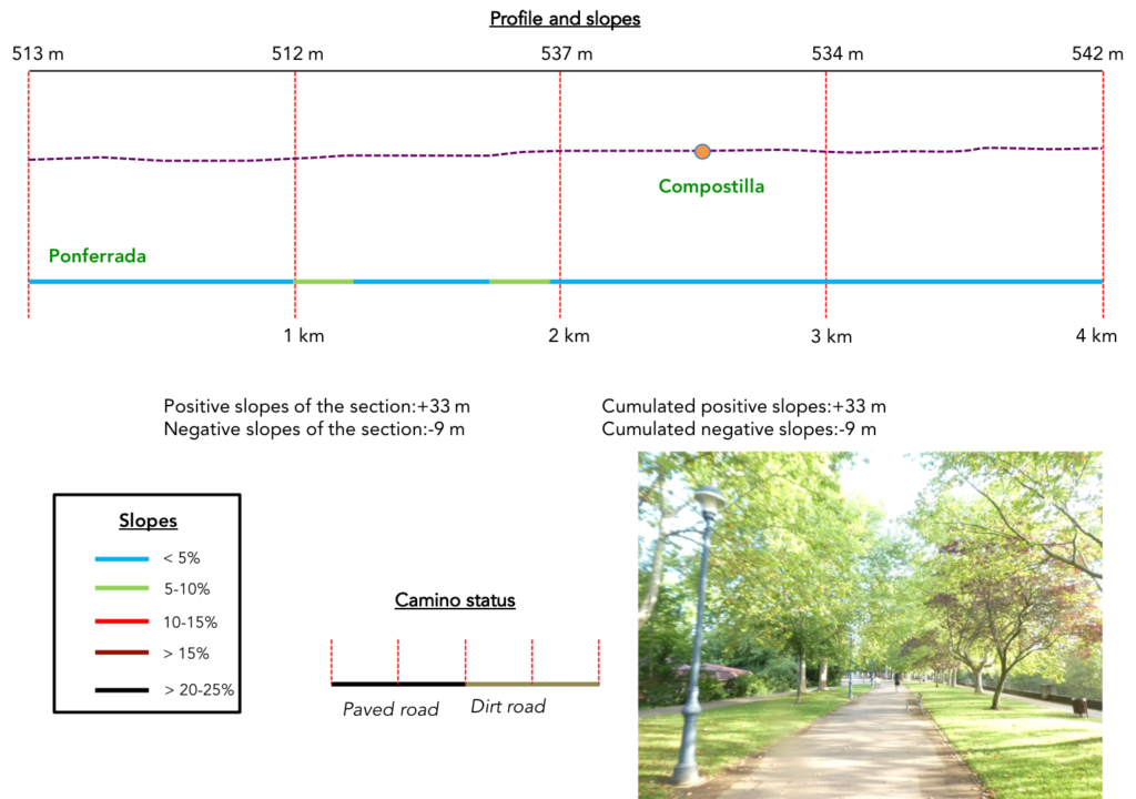
| The Camino descends from the Casco antiguo de Ponferrada down the town through narrow streets and stairs. It is the typical architecture of the old town, with whitewashed houses, very colorful, with also galleries. |
 |
 |
| Further down it finds the Rio Sil, the beautiful river that descends from the mountain. |
 |
 |
Here you can still see the fortress above the ravine carved out by the river.

| The Camino descends towards the river, crosses a beautiful park planted with horse chestnut trees on the Huertas del Sacramento. |
 |
 |
| On the route, it passes near the municipal library, near a bridge over the river and continues in the park, always following the river. |
 |
 |
| Further on, after skirting football pitches, it runs under the arch of the Centennial Bridge, one of the roads entering the city. |
 |
 |
| It is near the bridge that the Museum of Energy is located, which presents didactic panels and beautiful statues in the garden. |
 |
 |
| In front of you then stands a kind of slagheap where the pathway climbs toughly but briefly. Ponferrada has long been a mining town, an industry that collapsed at the end of the last century. |
 |
 |
From up there, you have a bird’s eye view of part of the city and the Rio Sil.

| There are industrial wastelands in the region. The Camino then follows on the sidewalk a road that heads towards Compostilla under the plane trees. |
 |
 |
| Further on, it enters the porch of a building belonging to a large local company, ENDESA, which is interested in energy. The whole neighborhood you cross belongs to this company, in squared streets. Does the church belong to them too?… |
 |
 |
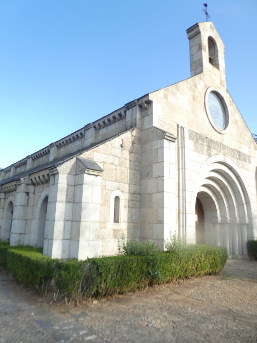
…because behind the porch appears the Church of Santa Maria de Compostilla. This neo-Romanesque style church dates from the second half of the last century.

| Anyway, it is a very well wooded park, a real haven of peace. |
 |
 |
| Further on, the road runs along a football field, crosses the small town, which looks like a collection of small apartment buildings and individual houses. No one will tell us where ENDESA’s investments in Compostilla stopped. |
 |
 |
| Shortly after, the road takes the direction of the countryside. |
 |
 |
| Along the way, it passes under the main national road of the region, the N-6 road. |
 |
 |
| Further on, it approaches Columbrianos. |
 |
 |
Section 2: From town to town.
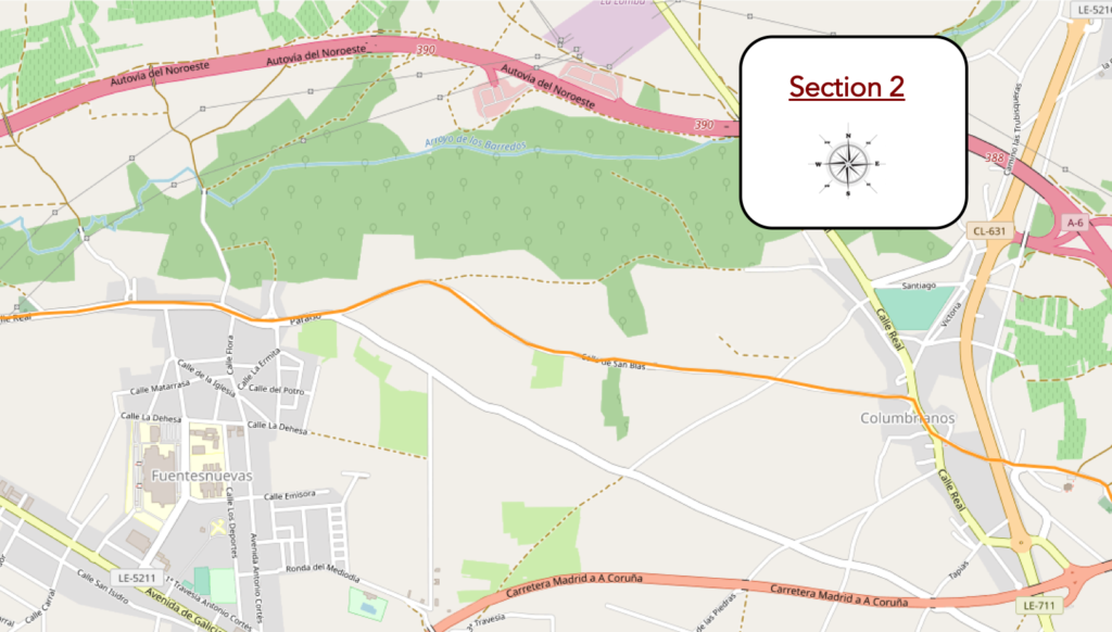
General overview of the difficulties of the route: course without any difficulty.
| The road then crosses meadows and vineyards… |
 |
 |
| …to reach the outskirts of Columbrianos. Here, you are even offered grapes. |
 |
 |
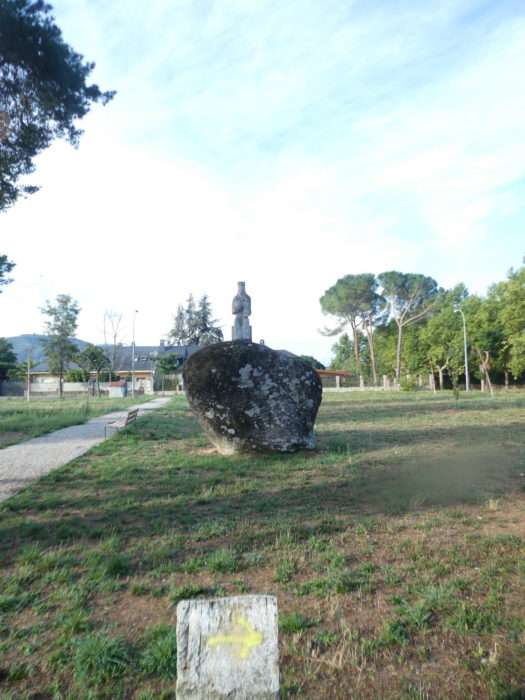
| Before reaching the center of the tiny town, you’ll find the Church of San Esteban, which dates from the end of the XVIIIth century, with its tower-belfry rebuilt in the last century, having collapsed by lightning. |
 |
 |
| Further on, the road reaches the town, crosses a very busy road. You will often feel that these places are dead, at certain parts of the day. Columbrianos still has 1,400 inhabitants, but it is a very tiny town. Formerly, the locality even went to the current Ponferrada, It was the oldest place in the region, existing long before the city of Ponferrada found its current status thanks to the Camino de Santiago. There was a pilgrim hospital here. |
 |
 |
| Here, you find the San Blas y Roque hermitage, of which you do not know what is inside, the chapel being closed. On the wall, a local artist has produced a naive fresco in tribute to the pilgrims who cross the country. |
 |
 |
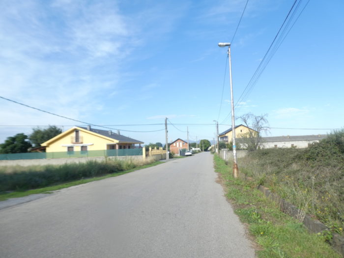
| The road goes out of the town, but you’ll have the feeling that there is no real exit, because all along the road the individual houses are scattered. |
 |
 |
| Here, it is an agricultural and livestock country, with horticultural and fruit products, as well as pastures for livestock. The vineyard is also sometimes present. Obviously, because of the urban development of the surroundings, the peasantry has melted a little. |
 |
 |
| In a landscape where nothing or very little happens, the road runs by, without much interest. And you have to walk on the tarmac here, because there is no dirt shoulder. |
 |
 |
| Rarely, you can catch an eye on the rather rare cattle here or on a pilgrim cyclist who advances faster than you on the road |
 |
 |
| Further on, the number of houses increases at the edge of the road, because you will arrive at a new small town. |
 |
 |
| At the entrance to Fuentesnuevas stands a beautiful granite cruceiro. The tiny town, which has 2,700 inhabitants, is of medieval origin, and like all the places in the region owes its current growth to pilgrims. Here, they are numerous, seated to have breakfast. |
 |
 |
| At the beginning of the locality you’ll find the Hermitage del Divino Cristo, once called the Hermitage of Vera Cruz. Formerly, the XVth century hermitage was made of crushed clay and stone, all lined with lime mortar, crowned with a small stone bell tower. The stone hermitage was rebuilt in the XVIIth century, keeping the bell tower. Through the window, you can see that the altar is simple, but baroque. |
 |
 |
| The road crosses a fairly beautiful town, with half-timbered houses, sometimes reminiscent of the village of El Acebo, sometimes with stone houses, with balconies or vaulted doors, lost in the middle of simpler constructions. The main monument remains the parish church, decked out by several names, Iglesia de Santa María, Iglesia de la Asunción or even Iglesia de Nuestra Señora. This is all that will be said of this church, closed to our passage. Soon, it will be necessary to have a pass or a schedule to visit the churches. And to get the “credencial” stamped, essentially Christian, you will have to go to the bar or the inn. |
 |
 |
| Shortly after, the road starts again at the end of the town. |
 |
 |
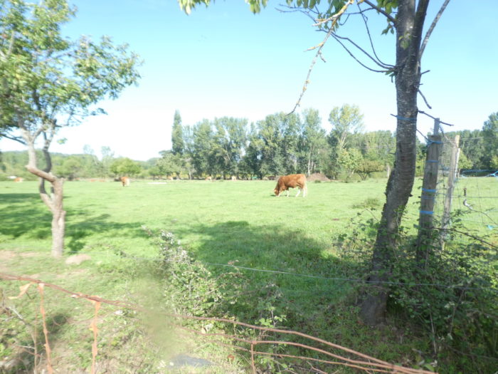
| It is claimed here that cattle farming is on the increase. Fortunately, these brown cows, whose breed we don’t know, are there to prove it, because we haven’t encountered many of them. |
 |
 |
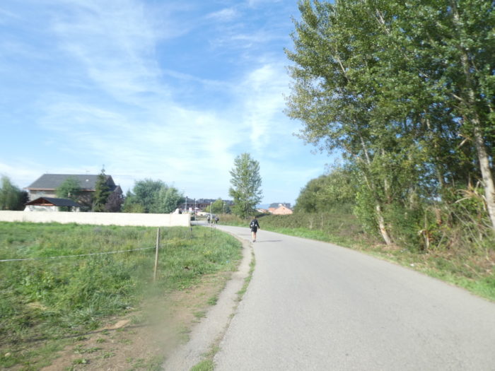
| And the pleasure lasts, seemingly for an eternity, on this monotonous road. On the horizon stand out the mountains of León, which you will cross tomorrow, at the end of the Bierzo plain. |
 |
 |
Section 3: In the Bierzo countryside.
General overview of the difficulties of the route: course without any difficulty.
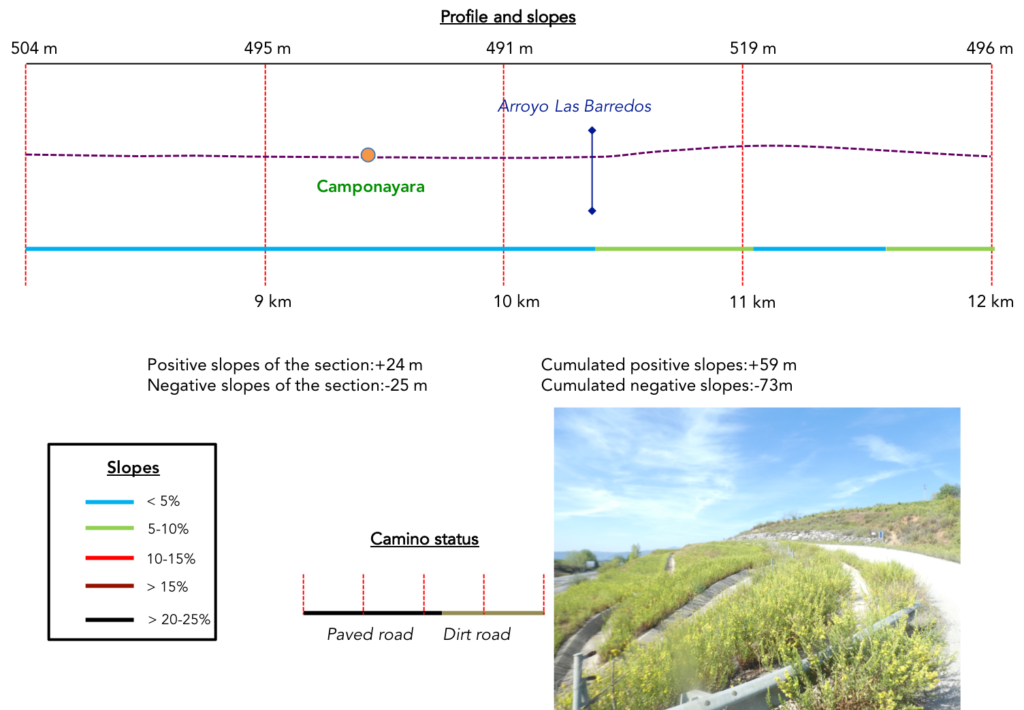
| And the road goes by like this, sometimes with islands of black poplars, in corn and horticultural crops. You see many flower greenhouses far from the road. The region specializes in growing lettuce and peppers. Peppers have been grown here since the XVIIth century. The “pimientos asados del Bierzo”, roasted peppers, have become one of the symbols of Bierzo. You will eat them in all the inns in the region. |
 |
 |
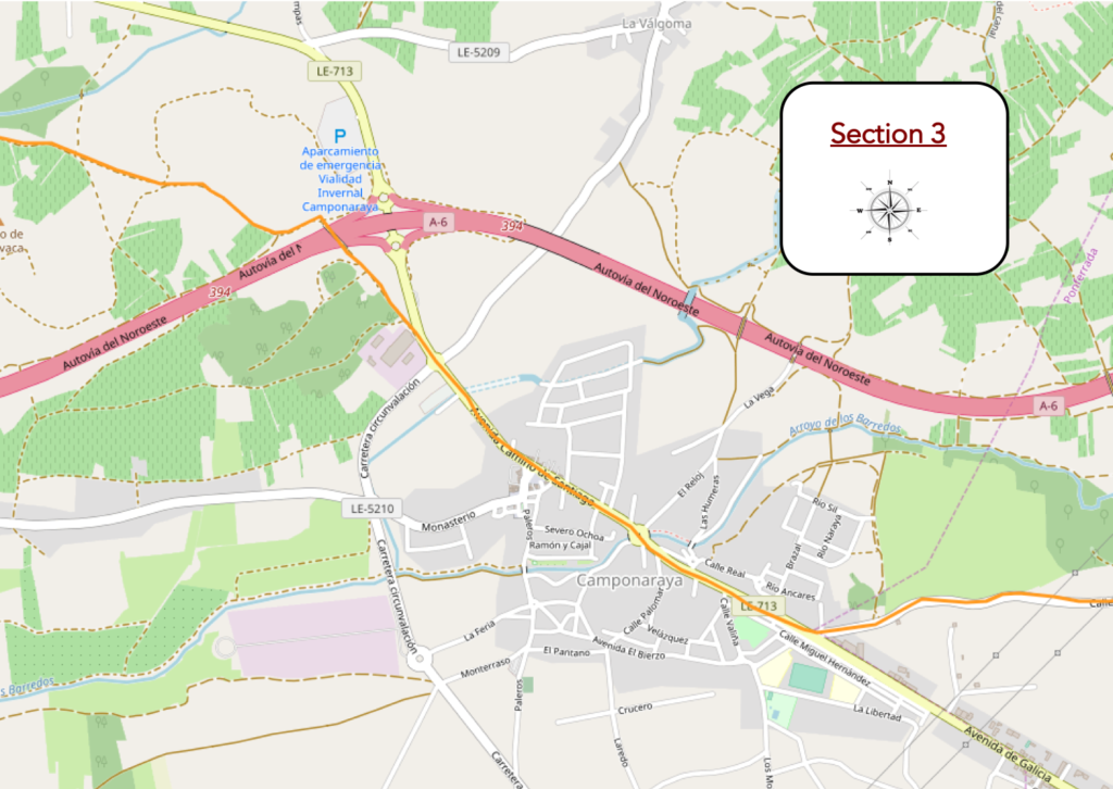
| The road then arrives at Camponaraya, a small town of 4,200 inhabitants. Here, the Camino crosses a long, endless street. The architecture is more like that of a small town than that of a village in the region. |
 |
 |
| The current Camponaraya was born as a single locality in the XVth century. Formerly, the Naraya stream separated the localities of Campo, located on the side of Cacabelos, and Naraya, on the side of Fentesnuevas. In the Middle Ages, the city had two hospitals for pilgrims. The particularity of these regions is that a Galician patois is often spoken there, but the common language is Spanish, with Galician accents. Formerly, the region was under the control of Galicia, before the Catholic kings imposed the Castilian central administration there in the XVth century. You can see how difficult it is to break away from old customs. |
 |
 |
The parish church is dedicated to San Idelfonso. Of recent construction, it is made of red bricks, with a high bell tower.

| Further on, near the bridge over the Naraya River, stands a curious brick tower, built in the last century, which houses a clock. |
 |
 |
| The crossing of the town is long, with many possible stops for pilgrims. |
 |
 |
| Further ahead, the road heads to the hermitage of the Virgen de la Soledad, a chapel guarded by two towers. It is in September that the town organizes a procession to celebrate the Virgen de La Soledad, an occasion for great local celebrations. |
 |
 |
| At the exit of the town, the route will finally change. Beyond the roundabout, you will leave behind you this long tarmacked road that you followed from Ponferrada and a landscape that we would say a little repetitive, to put it mildly. |
 |
 |
Avant de de pénétrer dans les vignes, vous pouvez aller renifler les effluves à la cave coopérative Viñas del Bierzo. Tout y est organisé pour le pèlerin : visite guidée, dégustation, achat, toilettes, et tamponnage du “credencial”.

| Then, beyond a very sober cruceiro and a beautiful fountain, where the wine does not flow, a pathway slopes up to join the highway, passing towards a center of interpretation of the wines, so present in Spain, aimed at making visitors discover the history of the region’s wines, as well as tillage techniques and production and processing systems. |
 |
 |
| Shortly after, it is the crossing of the A6 motorway, the Autovia del Noroeste, a motorway with little traffic, as generally in central Spain. |
 |
 |
| A wide ramp leads above into the vines. |
 |
 |
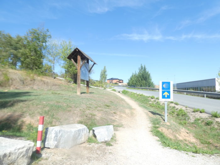
| On the Camino francés, as soon as there is a fork of tracks, the signs are always present to indicate the direction. |
 |
 |
| Shortly after, the pathway leaves the vines to approach undergrowth. |
 |
 |
Section 4: Passing through Cacabelos, the cradle of Bierzo.
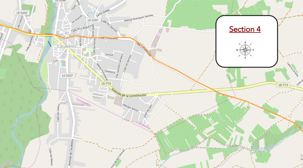
General overview of the difficulties of the route: course without any difficulty.
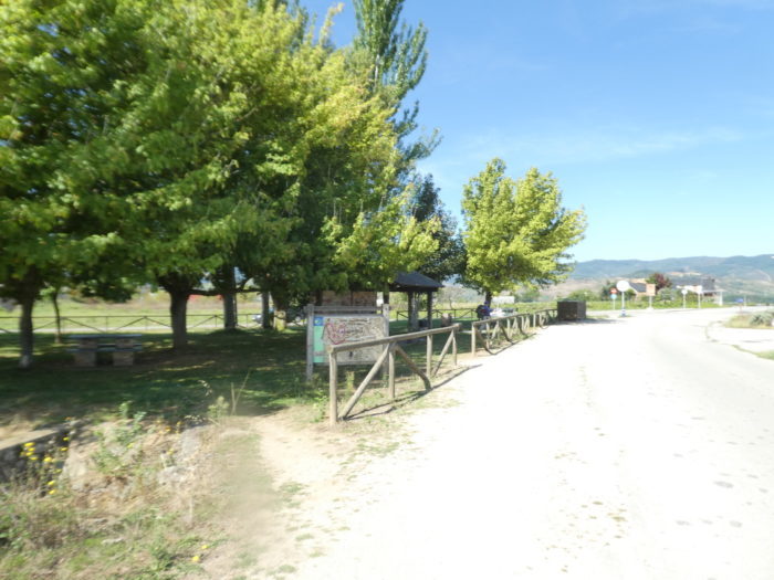
| At the bottom of the slight descent, a picnic spot is hidden under the trees. Here, you see large black poplars but also chestnut and walnut trees. |
 |
 |
| Here, the La Reguera stream brings a welcome coolness. |
 |
 |
| The pathway still wanders a little in the coolness under the imposing poplars. Here, you’ll cross the psychological barrier of the 200 kilometers that separate you from Santiago. |
 |
 |
| Then, the Camino alternates between the vines and the meager undergrowth… |
 |
 |
…before emerging in the barer nature of the compact vineyard. The phylloxera crisis at the beginning of the XXh century led to the death of most of the vineyard, as in all of Europe. The vines were replanted with American grafts, as everywhere in Europe. Here, it is above all the red Mencia grape variety that has the right of citizenship.

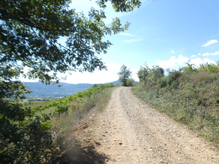
| Further afield, the pathway slopes up gently along the vines planted in what looks more like a field of stones than dirt. Bierzo wines are full-bodied. And for good reason, in the stones, with the sun beating down, it is written in advance. The peasants even planted olive trees in this barren land. It is so rare to find olive trees in the North of Spain. |
 |
 |
| At the top of the hill, the Camino intersects the N-6, the national road that crosses the vineyard, and flattens on a secondary road towards Cacabelos. |
 |
 |
| Here, you can walk on the small strip of dirt at the edge of the road, which heads towards the town, still in the middle of the vineyards. |
 |
 |
| The winegrowers today have taken out their equipment, and you are approaching a more semi-industrial zone. |
 |
 |
| Further on, a picnic spot and a fountain under the trees. Finding fresh drinking water in almost all the fountains of the country is a viaticum for the pilgrim, even if it is not always drunk. Long live Spain! |
 |
 |
| The road then descends gently towards the small town. |
 |
 |
| At the entrance, nestles an unusual restaurant, a tavern with large interior terraces under the trees, with a bric-a-brac grocery store, where you can find, among other things, all the preparations based on peppers that farmers know how to imagine and manufacture in the Bierzo. |
 |
 |
| We have told in the introduction the first times of the city until the XIIth century. When Ventosa fell into abandonment, the birth and development of Cacabelos took place. The town continued to grow in the Middle Ages. It was an important medieval stopover for pilgrims with 5 pilgrim hospitals and 4 churches, the majority of which have now disappeared. Later, at the beginning of the modern age, the city became the property of the Marquises of Vilafranca del Bierzo. During this period, Galician was introduced, still a minority today. It was not until the XIXth century that the city became part of the province of León. Today, the city has 4,800 inhabitants.
The crossing of the town is also long, in a central street, often quite deserted. |
 |
 |
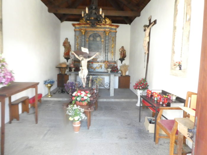
| Further on, stands the hermitage of San Roque, formerly called the Hermitage of Vera Cruz (Chapel of the True Cross). This building was rebuilt many times, the last dating back to the end of the XVIIIth century. We cannot describe the interior to you, the door being closed. But yes! |
 |
 |
| Nor can we describe the interior of the Iglesia de Santa María de la Plaza, dating back to the XIIth century, rebuilt in the XVIth century. Only the Romanesque apse remains from the original church. A neo-Romanesque clock tower was added to it in the XXth century. You can count on your fingers the churches of Europe that have managed to cross the centuries, intact. One hand should be enough. |
 |
 |
| On the other hand, people cannot yet close the passage in the streets. Cacabelos is a very beautiful town, with very colorful streets of small squares, where pilgrims crowd as usual; always representing the largest part of the people you meet during the day. |
 |
 |
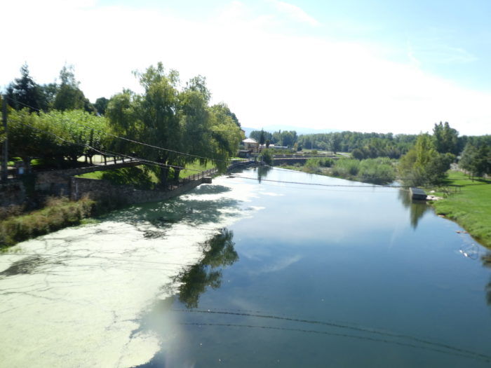
| Leaving Cacabelos, the Camino crosses the beautiful and wide Rio Cúa, a river that has sucked the clay and carved out the valley. |
 |
 |
| A stone’s throw away stands the Sanctuary of the Angustias. The Santuario de Nuestra Señora de la Quinta Angustia (Sanctuary of Our Lady of the Fifth Sorrow) dates from the XVIIIth century. We did not enter it, but today the building has mainly become the municipal “albergue”, on buildings that may have once been part of a hospital for pilgrims in the Middle Ages. |
 |
 |
| Further on, the Camino crosses the outskirts of the town… |
 |
 |
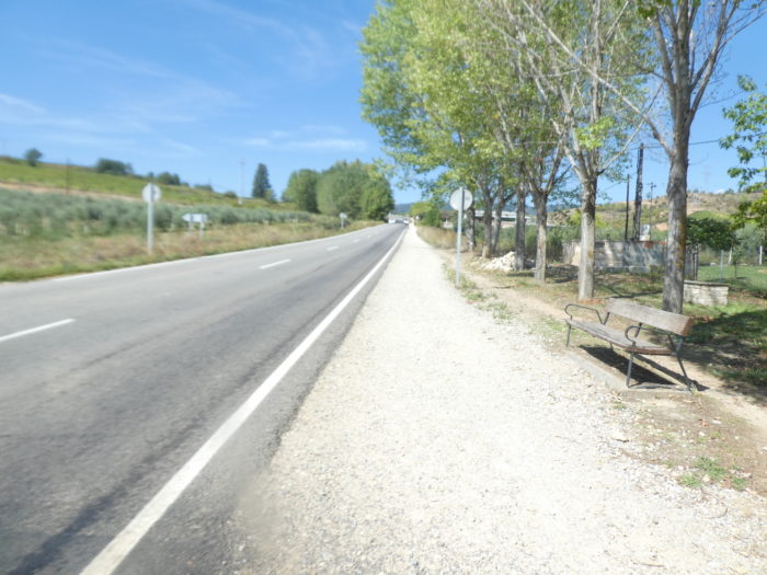
| …before turning onto the sidewalk, then onto the gravel, along the LE-173 road, a little exercise that you will enjoy, that’s for sure. |
 |
 |
Section 5: In the vineyards of Bierzo.
General overview of the difficulties of the route: the only somewhat demanding climb of the stage.
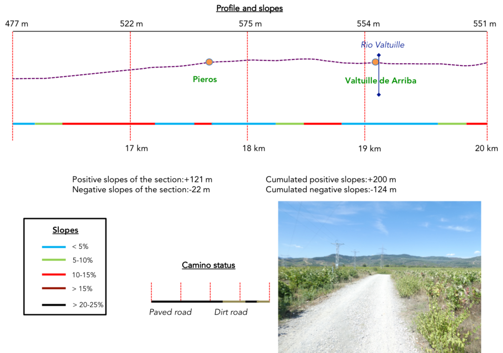
| It is the return to the traditional “senda de peregrinos” that you have undoubtedly appreciated at its fair value in the Meseta. And it climbs steeply for nearly 2 kilometers. Nothing is happening. So, you take a look at the passing cars, or on the other side at the fruit trees and rare vines that haunt the hill. |
 |
 |
| Oh no! You learn on the way up that you are only 194 kilometers from Santiago. So, you start off with a lighter step. |
 |
 |
| Much higher, the Camino gets in Pieros. |
 |
 |
| So here, the Camino twists the road to pass through the village, a beautiful village with flowers and clothes drying on the wooden balconies. |
 |
 |
| There is a fountain at the exit of the village and the Camino continues to climb on the LE-173 road. |
 |
 |
| Further up, there is a fork to consider. Because there are two routes to get to Villafranca del Bierzo. There are the fans of the “senda de peregrinos”, who do not even raise their heads and continue straight ahead. They will be one kilometer less than on the variant. Bof! Because, the variant leaves the LE-173 road on the right to follow a small road which heads towards Valtuille de Arriba. There is no photo here: take the variant. |
 |
 |
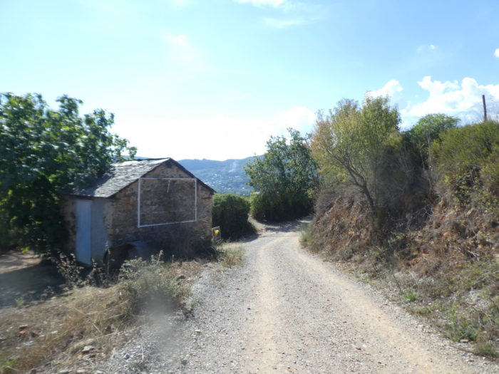
| Further on, dirt replaces tar in the vines. |
 |
 |
| It is a beautiful place for the vineyard. A mild average annual temperature characterizes the climate of this region. Winters are cold, with frequent fog and snow. In summer, the temperature can rise to very high temperatures. Winter and spring are often rainy, all conditions favoring the vine. |
 |
 |
| You will no doubt verify that many pilgrims pass through the variant. |
 |
 |
| Further on, the pathway descends steeply towards Valtuille de Arriba. |
 |
 |
| It is a charming village of winegrowers, with curious and old houses with gables on the street, often very colorful. A stream runs through the middle of the village. |
 |
 |
| At the exit of the village, the dirt road finds a little undergrowth… |
 |
 |
| …before finding a more tough slope to reach the vines above. |
 |
 |
Here, you learn that Mencia, the local grape variety would be derived from Cabernet franc, brought by a French pilgrim.

Section 6: Some undulations in the vines.
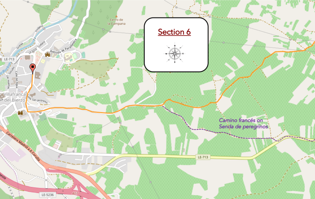
General overview of the difficulties of the route: course with some slopes, most often downhill.
| The route to Villfranca del Bierzo is quite hilly. The pathway climbs a little further on the mound. You see that you are rapidly approaching the foothills of the mountains of León. |
 |
 |
| The pathway scrolls and undulates like a big snake on the gentle hill in a postcard landscape, in the middle of vines and holm oaks. |
 |
 |
| Shortly after, it climbs a little more on a hillock in the red and stony ground. |
 |
 |
| Further on, near the limestone engraved by pilgrims, you approach 3 kilometers from the end of the stage. Here also grow a few rare olive trees. |
 |
 |
| And the game continues like this for more than a kilometer, from one vineyard to another, sometimes with umbrella pines or large oaks as companions. Nature is beautiful and generous here. The vines, whatever the country, always have this added magic. |
 |
 |
Further on, a winegrowers’ gatehouse is planted like a benevolent semaphore.

| Soon, you see below the sails of the market gardeners in the plain. |
 |
 |

| Further on, the density of gatehouses increases on the way. You are getting closer to Villafranca del Bierzo. |
 |
 |
| Shortly after, the two routes, the one that follows the road and the variant, meet on the heights of the city. |
 |
 |
| So, it’s the paved road that gently slopes down for almost a kilometer into the valley. |
 |
 |
| Further down, approaching the city, you will see the steeple of the monastery of San Francisco on your right. |
 |
 |
You will then arrive above the city. There, the imposing Monastery of San Francisco dominates the city.

Section 7: Visit of Villafranca del Bierzo.
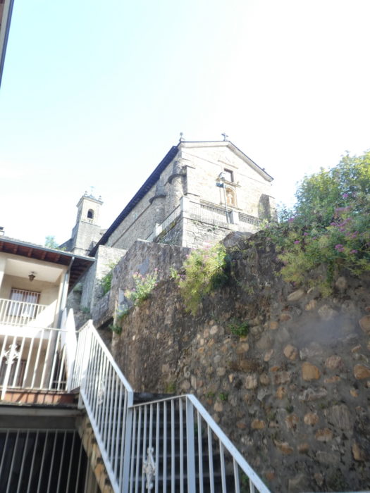
| Villafranca del Bierzo is a real open-air museum. The monuments are very present throughout the city. The slope is present enough to reach the center. The first monument you will find is the Romanesque church of Santiago Apostól (Saint James the Apostle), an austere and massive building. This one-nave church, begun in the Romanesque period at the end of the XIIth century and completed in the XIIIth century, is therefore an example of the transition between late Romanesque art and nascent Gothic art. Additions took place later, including the bell tower with two openings. |
 |
 |
The church, apparently, cannot be visited. The majestic Puerta del Perdón (Gate of Forgiveness) is only open during Holy Years. The tradition dates back to the XIIth century, when the pope granted a privilege, decreeing that pilgrims unable to continue to Santiago due to illness or injury could receive absolution here, if they confessed and received the communion on your knees, crossing the steps of this door. For this reason, Villafranca del Bierzo was sometimes called the “little Santiago”. This door is not the most beautiful of the churches in Spain, but it is a source of symbols. During the XXth century, it was even barricaded to prevent potential damage.

| Shortly after, you will pass the Castillo de los Marqueses, with its towers at the four corners. This palace was built by the Marquises of Villafranca in the XVth and XVIth centuries on the remains of an ancient castle. It looks more like a palace than a fortified castle. Quadrangular in shape, it is made of masonry stones and bricks. The castle was ransacked by the English, then by the French during the XIXth century. Restored, it still belongs to the Marquises of Villafranca. |
 |
 |
| The Camino descends in beautiful sloping lanes towards the town center. |
 |
 |
| At the bottom of these, you can climb the other side of the hill to see the majestic Monastery of San Francisco, located on one of the highest points in the city. It is claimed that Francis of Assisi himself, during his pilgrimage to Saint-Jacques, founded the monastery at the beginning of the XIIth century, but the legends still live on. It is not the only monastery attributed to the saint on the Camino de Santiago. It is also thought that the church could have been part of a hospital for pilgrims. The church is the only thing that is preserved from the monastery. The access gate to the church is Romanesque, but a large part of the facade is from the XVIIth century. However, some structural elements show Gothic lines, such as the apse, built during the expansion of the second half of the XVth century.
When you have climbed all the steps (and there are many) you may, like us, have the displeasure of finding the door closed. So, for the Baroque-influenced interior, all you have to do is let your imagination run wild. Come on! We understand a little the flow of pilgrims who no longer even go to the churches on the route. |
 |
 |
| From the courtyard of the church, you have a bird’s eye view of the Castillo and the city center, where you can guess the other monuments emerging from the black slates. |
 |
 |
| Without going back to prehistory, the Roman occupation and the incessant conflicts between the Muslims established in Galicia and the kings of Asturias, the region passed under the rule of Alfonso II, known as the Chaste at the end of the IXth century. It was during his reign that the supposed tomb of St James was discovered in Santiago. So, Villafranca del Bierzo would have been founded by French monks of the order of Cluny at the beginning of the XIth century, building the Monastery of Santa María de Cluniaco here, meeting the needs of the many pilgrims who passed through there. This place was in fact the antechamber of the narrow valley of the Río Valcarce, where you will pass tomorrow, to arrive in Galicia. As the monks were French, some French pilgrims chose to stay here, giving the village the name Villa francorum (city of the French), which eventually gave way to the Spanish version Villafranca. For several centuries, there were two magistrates in the city: one for the French and one for the rest of the city. It is also to the French that we owe the finding of vineyards in the region and the initial development of pilgrim hospitals. There were once up to 8 monasteries and 6 pilgrim hospitals. Villafranca was in itself a destination for some of the pilgrims from Santiago. We have already mentioned about the Church of Santiago Apostól.
It is relatively easy to navigate the city (2,800 inhabitants). It is a loop, which from the Plaza Mayor takes the street of the Way of Compostela, the Calle de Ribadeo that slopes down to the river, the Rio Bubra and slopes up towards the city center by the Calle de la Almelada Baja. The Monastery of Santa María de Cluniaco is at the bottom of the loop. |
 |
 |
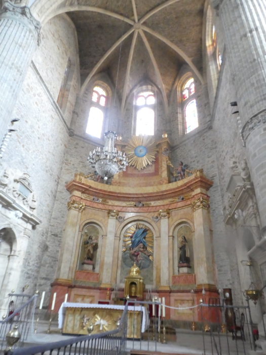
| The Colegiata de Santa María de Cluny or del Cluniaco was built in the middle of the XVIth century, on the remains of the Monastery of Santa María de Cluny from the XIth century, which has now disappeared. The decline of the monastery began at the beginning of the XIVth century, following a drop in pilgrimages. So, the Marquis of Villafranca erected a new church in the style of the great Romanesque basilicas. Although begun in the XVIth century, the building was in fact never finished, mixing architectural styles.
But, no matter the variation of styles, since for once we found an open church here, let’s take advantage of it. The church is still a “Bien de Interés Cultural”, the Spanish heritage register. It is a very beautiful church, bright and sober, apart from the altars. It is a jewel of Spanish late Gothic, with a strong Renaissance and especially Baroque influence. The naves and apse are covered with a remarkable network of slate vaults and cupolas. |
 |
 |
 |
 |
The Iglesia y Colegio de San Nicolás el Real (Church and School of Saint Nicholas the Royal) is located in the historic center of the city, a stone’s throw from the Plaza Mayor. The church seduces with its magnificent size and its sense of harmony, inspired by the buildings of the Italian Renaissance. The construction of the building began at the beginning of the XVIIth century, with the convent and the school. It is a Jesuit building. The church was built later, until the XVIIIth century. At the end of the XVIIth century, the Jesuits were expelled, as in much of Europe. But the school continued to function. Later, the building was used by the administration of the city, then after having become a school again at the end of the last century, it is today a museum of natural sciences.

| During the Middle Ages, the city had become important, especially because of the papal bulb, which granted pilgrims the privilege of not having to continue the journey to Santiago to obtain the same indulgences. At that time, the Way of Compostela was a real market, many rich people sending their poor or their people to do the way in their place, and obtain by this means the indigence, which allowed them to shorten their stay in purgatory. It is a safe bet that many pilgrims arriving here contrived to find imaginary illnesses or to exacerbate their sores so as not to have to go any further.
At the end of the XVth century, the Catholic Kings Fernando and Isabela granted the lordship of the town to the Marquises of Villafranca del Bierzo. At the beginning of the XVIIth century, Villafranca became the headquarters of the army of Galicia. During the War of Independence (1808-1814), it was ransacked three times by the British and looted by the French. In 1822 the province of Villafranca del Bierzo was created, with Villafranca as its capital. However, this only lasted a decade, because the new administrative division of Spain decreed that this territory would be divided between the new provinces of Ourense and León, the city being attached to Castilla y León. Villafranca del Bierzo is the last town in Castile before entering Galicia. With all this history, you will not be surprised that from Ponferrada to Villafranca, the Galician patois still survives. It is the historical capital of the region of El Bierzo, although Ponferrada is now the capital of the comarca of El Bierzo.
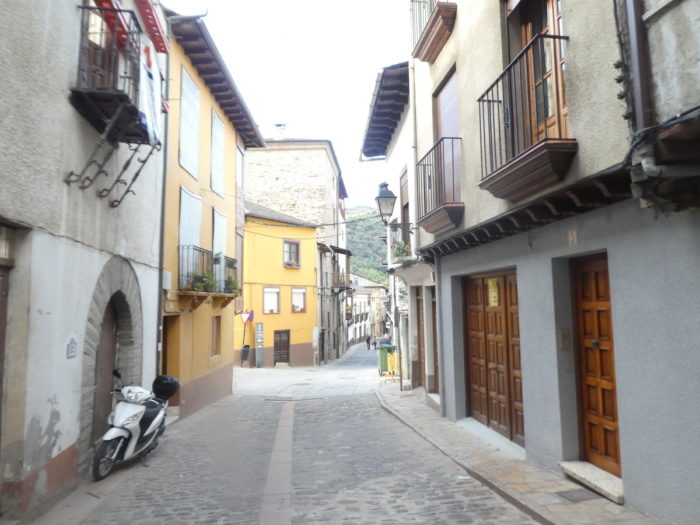
It is through narrow streets that you reach the Plaza Mayor, where the heart of the city beats. |
 |
 |
 |
 |
Logements


Feel free to add comments. This is often how you move up the Google hierarchy, and how more pilgrims will have access to the site.
|
 |
Next stage : Stage 8: From Villafranca del Bierzo to O Cebreiro |
|
 |
Back to menu |