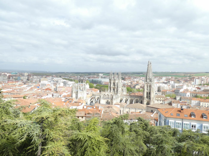
Perhaps the most beautiful cathedral in the world
DIDIER HEUMANN, ANDREAS PAPASAVVAS

We divided the course into several sections to make it easier to see. For each section, the maps show the course, the slopes found on the course, and the state of the Camino. The courses were drawn on the “Wikilocs” platform. Today, it is no longer necessary to walk around with detailed maps in your pocket or bag. If you have a mobile phone or tablet, you can easily follow routes live.
For this stage, here is the link:
https://fr.wikiloc.com/itineraires-randonnee/de-atapuerca-a-burgos-par-le-camino-frances-38227684
It is obviously not the case for all pilgrims to be comfortable with reading GPS and routes on a laptop, and there are still many places in Europe without an Internet connection. Therefore, you will find a book on Amazon that deals with this course. Click on the title of the book to open Amazon.
If you only want to consult lodging of the stage, go directly to the bottom of the page.
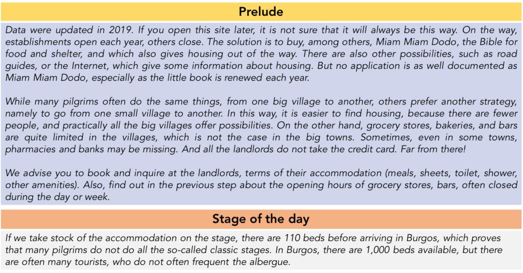
Today, the route first passes through the Matagrande massif. Here, nature is incredible, intact, powerful, superb in diversity and wildness. It’s beautiful, it’s magnificent on this pathway where you feel far from everything, just between earth and sky. What follows is less fascinating. It’s a long approach to Burgos, passing through small villages along the road, then large moorland and industrial districts. But, the pilgrim finds a smile in the large park where the Arlanzón flows. And then there is Burgos, of course. In the Codex Calixtinus, Burgos is the fifth stop in the Pilgrim’s Guide. Pilgrims entered it by the Gamonal door in the northeast of the city. It is said that you hardly lingered there, the city being only a simple stage on the Camino francés. But is it so true? The city had no less than thirty-two hospitals for pilgrims, including the San Juan Evangelista Hospital and the Hospital del Rey. Of course, the Middle Ages were a long time, and some pilgrims must have known of the beginnings of the construction of the church at the beginning of the XIIIth century and others could see the two spiers of the cathedral in the XVth century.
Located in the middle of the high plains of Old Castile, Burgos has been a Spanish crossroads for a thousand years. It was founded in 884 by Diego Rodríguez, Count of Castile, as a fortification to protect the surrounding villages against Muslim invaders. Its Visigoth name meant “fortified village”, which gave us the French name of bourg. Diego Rodríguez Porcelos, the second Count of Castile, consolidated the defensive lines his father had drawn to keep the Muslims away from the Ebro basin and the ancient Roman roads that linked La Rioja to northern Castile. At that time Castile depended on the King of Asturias. Rodrigo was first responsible for managing the city of Auca, which will become Montes de Oca, where you passed two days ago. It is to him that we owe in Oca, the monastery of San Felices and the church of Santa María. Faced with a large Muslim army, he then created a large defensive line on the Río Arlanzón. It was then Burgos and its castle on the hill. You know the rest. Rodrigo was buried in what remains of a pile of stones, before arriving in Montes de Oca. You have already visited it. It is not a prestigious mausoleum.
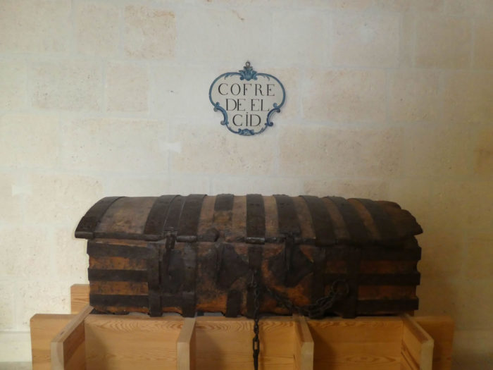
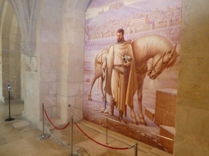
The second prominent figure in the city is Fernán González, who died in 970, who was the first autonomous count of Castile and founder of the dynasty that would rule a semi-autonomous Castile, laying the foundations for an independent kingdom. He wrested the entire region from the Muslims, and increased its independence from León. The third illustrious man is essential. Rodrigo, or Ruy Dìaz de Vivar was born near Burgos in 1034. Rodrigo came to dominate the Iberian Peninsula by the end of the Xth century, leading his own army independent of any king. Although he later became a legend and a national hero, especially of Castile, he was throughout his life under the command of various leaders, Christians and Muslims, during the Reconquista. His name was El Cid (from the Arabic Sidi meaning Lord). Captain of Sancho II, the first king of Castile, he distinguished himself in battle and acquired the name of El Campeador (master of battles in Spanish). On the death of Sancho II, he changed his coat and entered the service of the kingdom of León. It was the King of León, Alfonso VI the Brave who gave Rodrigo as his wife, Chimenea, who was a relative. Later, Rodrigo was banished from Castile and forced into exile. He then put himself at the service of the Muslims in Zaragoza. The Muslims, with whom he now fought, gave him the title of El Sid. Then, he became independent. In 1094, he seized Valence where he reigned until his death in 1099. Chimenea succeeded him at the head of Valence, but she had to cede the principality to the Moors. El Cid was first buried in the Cathedral of Valencia. However, when the city fell to the Muslims in 1102, his remains were taken to the monastery of San Pedro de Cardeña, near Burgos, where a stone tomb for him and his wife was built in the XVIth century. Then, his body traveled several more times, before being definitively transferred to its final resting place in the cathedral of Burgos, where El Cid rests next to Chimenea. The Cid had still been the central pawn on the chessboard of the Reconquista. The renegade had been forgiven. When you cross Burgos, you will see that the Cid is present everywhere. Le Cid, as much as Don Quixote, marks the history of Spain. He is both a historical and legendary character, well known to French speakers through the tragedy of Corneille.
During the union of Castile and León, at the beginning of the XIth century, Burgos became the capital of Castile and one of the capitals of Spain until Philip II. The city was very prosperous thanks to the wool trade in the XVth and XVIth centuries. At that time, the Meseta was not the great cereal field of today, but a country of sheep. Then, the city declined a little from the XVIIth century. It even experienced periods when it was taken by the French, then by the English, at the beginning of the XIXth century. It regained popularity when it became the seat of Franco’s government during the Civil War from 1936 to 1939.
In this magnificent town, where the Rio Arlanzón meanders through the city, where one can climb the stairs and narrow cobbled streets to the IXth century fortified enclosure enthroned at the top of the hill, the great Gothic cathedral dominates the city of its two spiers. The French will say that if the church is beautiful, it is because it is a replica of the Cathedral of Paris and that it was partly built by French architects. What braggadocio! For many experts and for many tourists, even French, Burgos is one of the most beautiful churches in the world, perhaps the most beautiful of the Gothic churches.
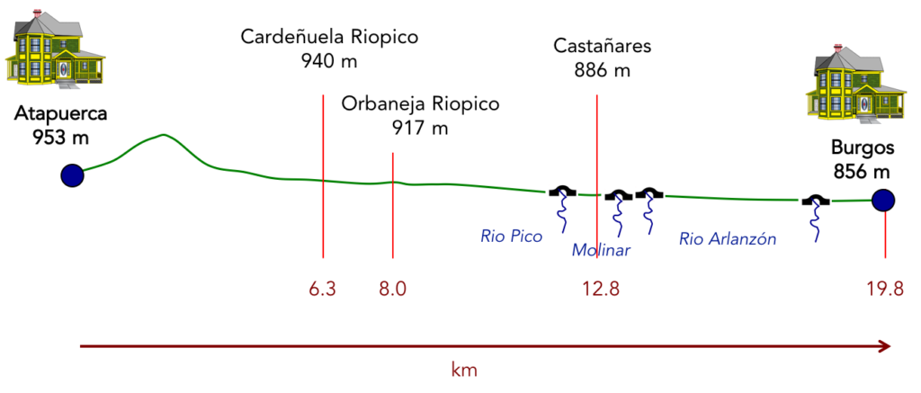
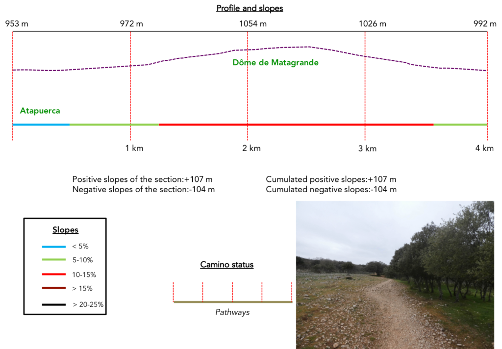
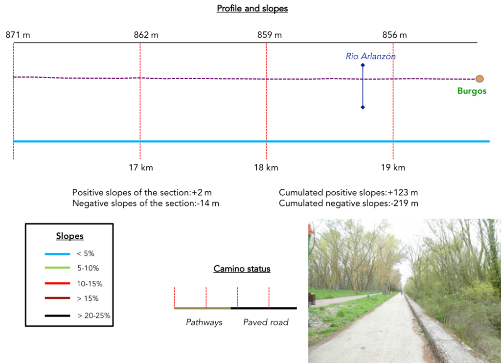
Difficulty of the course: Slope variations of the day’s stage (+123m/-210m) are insignificant. Only the climb to the Dôme de Matagrande at the start of the stage is a bit difficult, but the gradient does not exceed 15%.
There is a bit more paved road today:
- Paved roads: 6.6 km
- Dirt roads: 13.2 km
We made it all the way to León in one go, in a cold, rainy spring. From then on, many stages were made on soggy ground, most often in sticky mud.
It is very difficult to specify with certainty the incline of the slopes, whatever the system you use.
For “real slopes”, reread the mileage manual on the home page.

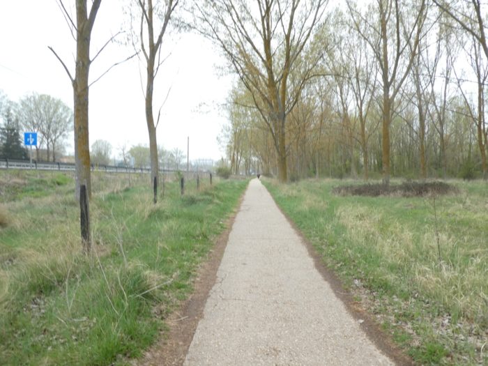
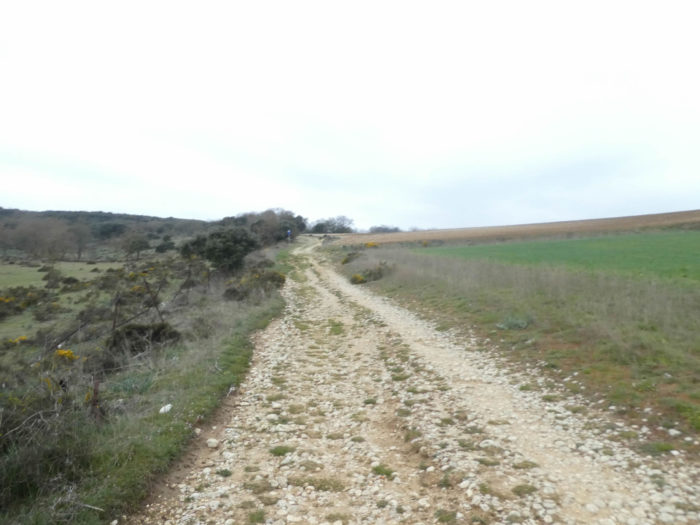
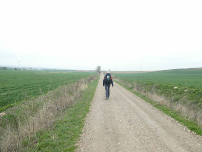
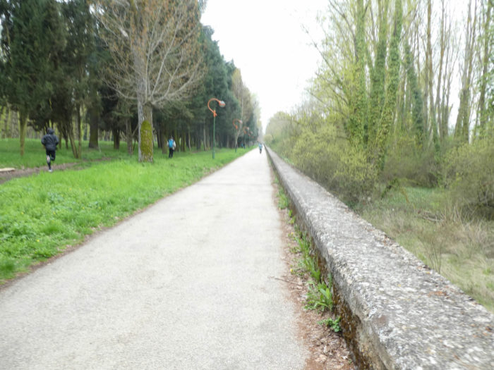
Section 1: Over Matagrande Dome.
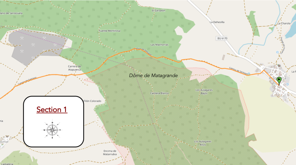
Overview of the difficulties of the route: the only real effort of the day, with slopes between 10% and 15%, both uphill and downhill.
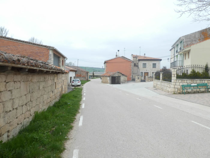
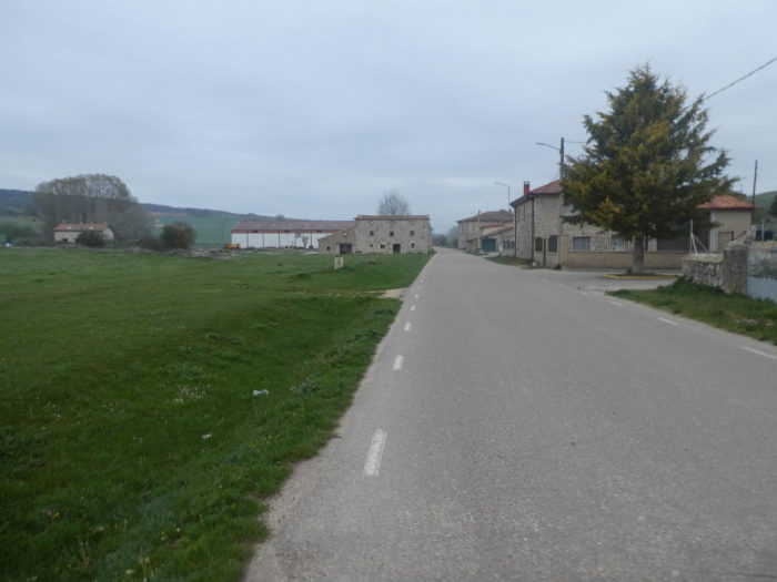
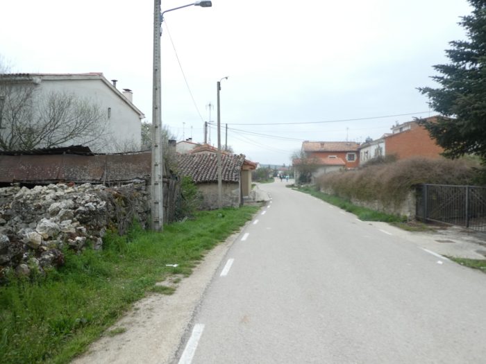
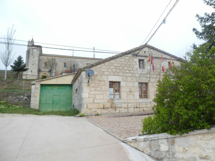
| The Camino quickly leaves Atapuerca behind stone farmhouses. |
 |
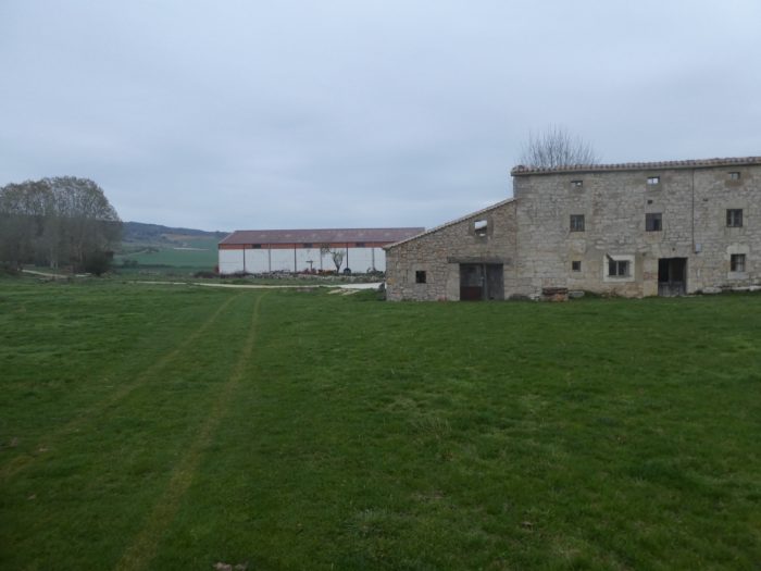 |
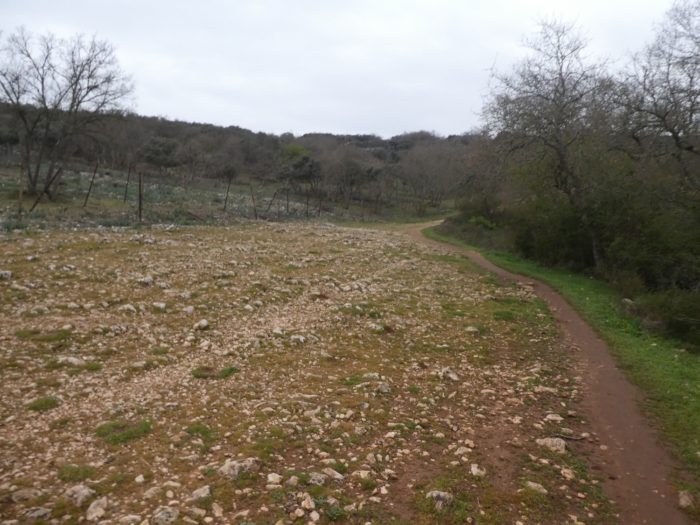
| Immediately a wide dirt road heads towards the mountain. Finally, mountain is a way of saying. |
 |
 |
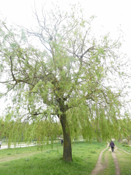
| What a pleasure to find a little life in the meadows. It’s been so long since we had not seen a single animal in the area, not even a dog in the villages. Here, they are black-headed Manech, the sheep of Pyrenees, who graze the grass of the steppe. Crops are rarer here. |
 |
 |
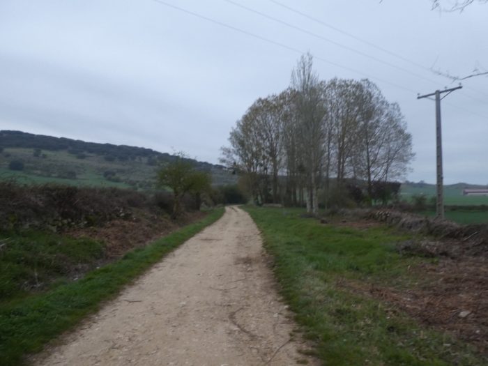
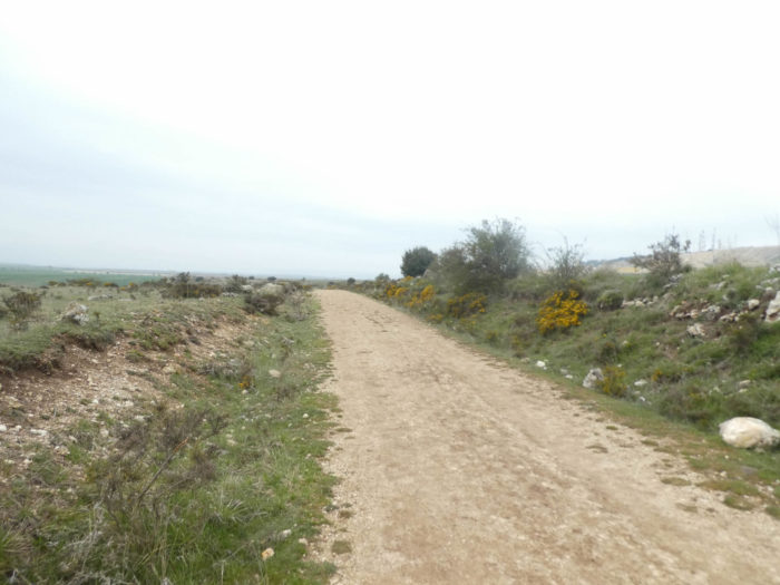
| Further up, the pathway becomes stony and begins to toughly climb in the middle of green oaks and some poplars lost in nature. Here you’ll find the green oaks, the encinas, these trees that adore the aridity of the peeled mountains and the pebble fields, the very ones that we met the first time in the Sierra del Perdón, near the wind turbines of Navarre. |
 |
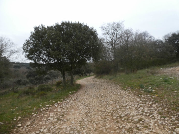 |
| Here, nature is incredible, untouched, powerful, superb of diversity and wildness. It’s beautiful, it’s wonderful on this path where you feel far from everything, just between earth and sky. |
 |
 |
| In this world of silence, rusty barbed wire marks part of the hill. Why did the military install one of their war set-ups on this magical hill? |
 |
 |
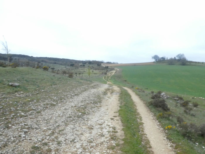
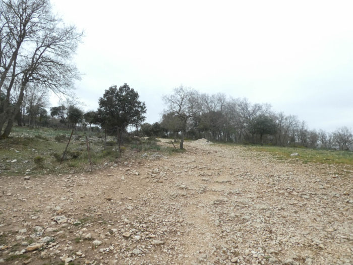
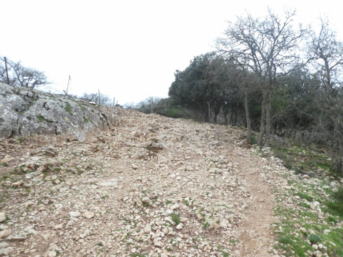
| Still a small field of limestone eroded by time, and the pathway reaches the top of Matagrande dome, near a large cross. |
 |
 |
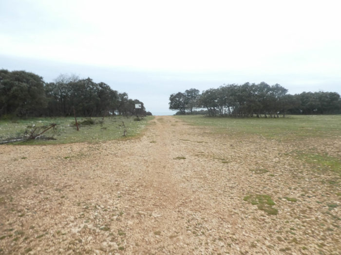
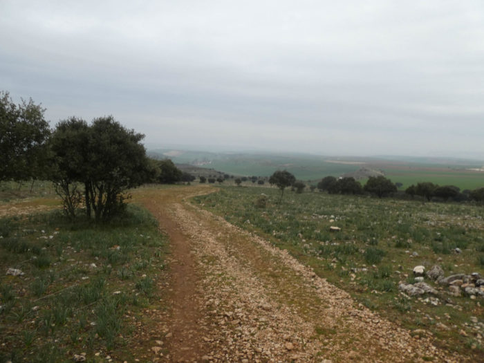
| The pathway remains a little on the peeled plateau of the dome in the sometimes-brown ground, sometimes ocher. You could stay there for days, so it’s beautiful, calm, serene. |
 |
 |
A sign is planted in the lawn telling a piece of text by Luciano Huidobro who wrote with colleagues “Peregrinaciones Jacobeas”in the middle of the last century. The text says in essence that since the pilgrim arrived at Burgete, he has never before seen a landscape more beautiful than the one taking place in front of his eyes.

And how can we not agree with the author of these simple words? It’s just divine, there’s no other word.

| The pathway then steeply slopes downhill from the mountain, in the primitive and silent majesty of this almost lunar landscape, where the eye is far away. We can only wish you not to share this peace of heaven and its heartrending beauty with the cohorts of pilgrims who speak loudly on the way. Only silence allows to taste this greatness. But even when it relates to excellence, there is a detail to disturb the magic. Atapuerca’s great career on the side of the mountain, why did not they build it on the other side of the hill? |
 |
 |
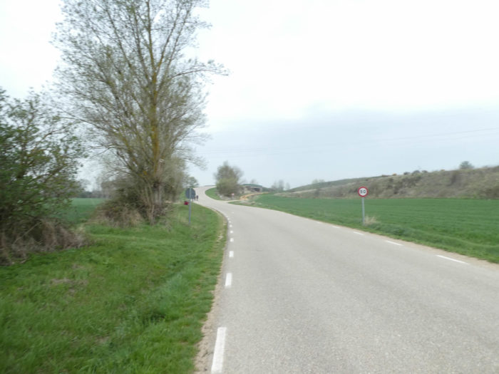
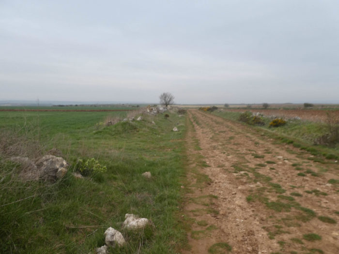
| At the bottom of the descent, you are welcomed to Riopico Valley. Valley, did you say valley? It is rather a high plateau of close-cropped steppe, with some lean bushes and some broom flowers. |
 |
 |
| Here there is nothing but the solitude of desert and sleepy landscapes. |
 |
 |
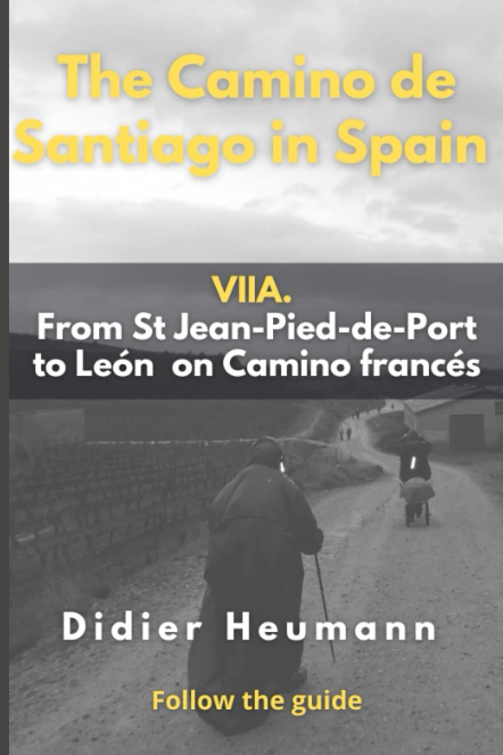
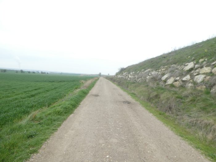
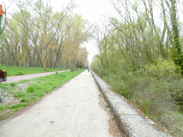
| Further down, the dirt road gets to the end of the high plateau and starts sloping down to Riopico Valley. |
 |
 |
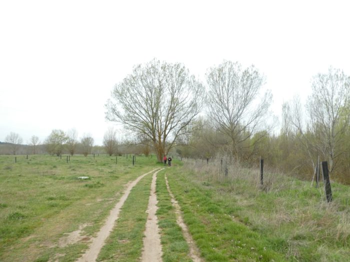
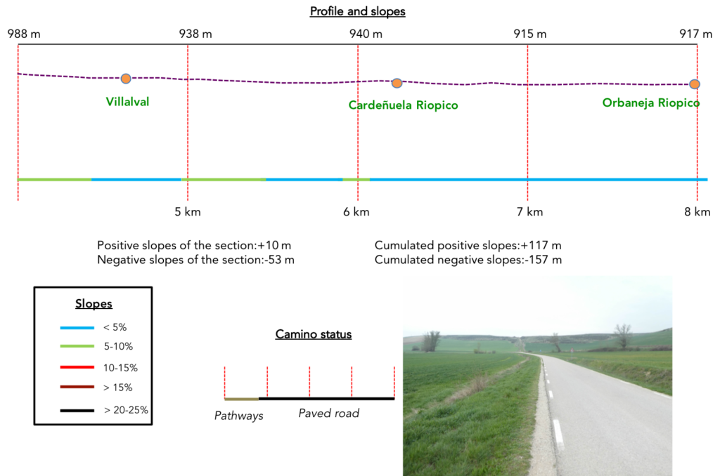
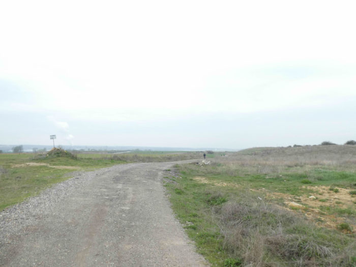
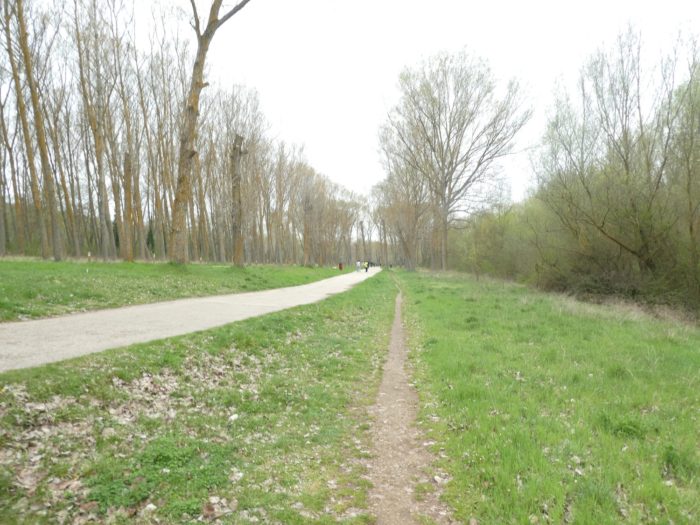
Section 2: Along Riopico Valley.
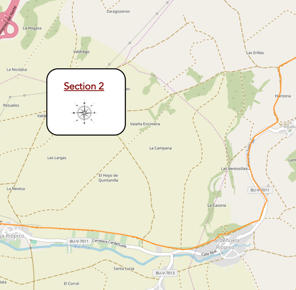
Overview of the difficulties of the route: course without any difficulty.
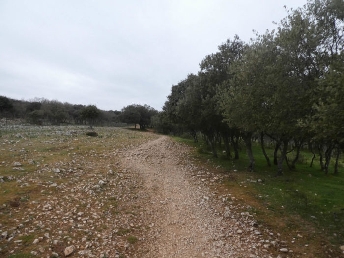
| Here, it is still a sandy highway that slopes downward into the valley, where you’ll see the return of grain crops. |
 |
 |
| The pathway runs above Villalva village, but does not go there. It is only joining the paved road coming out of the village. |
 |
 |
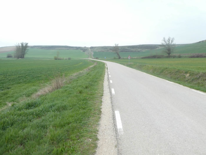
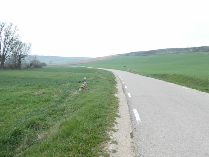
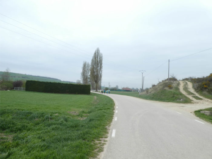
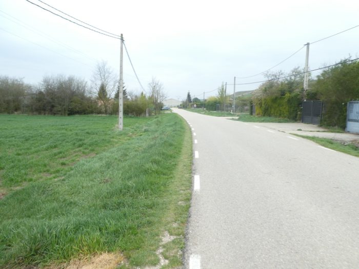
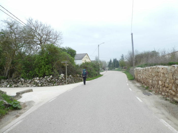
| Here the charm of Matagrande is away. This is the brutal return to the reality of the paved road. Even if you can always put your soles on the side of the road. Walkers on European Path # 1 travel in the same boat. |
 |
 |
| And still no tractor in the fields. They must probably be stored here in the hangars, waiting for better days. |
 |
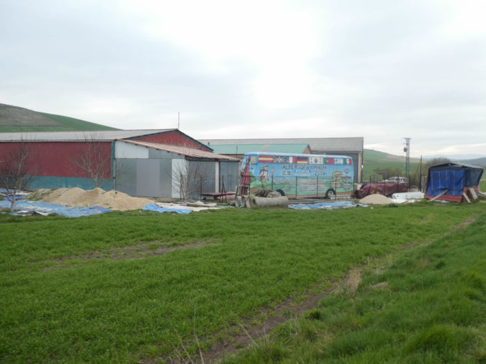 |
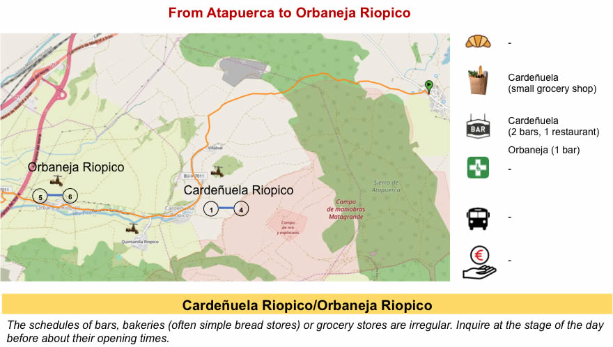
| The road arrives soon in the village of Cardeñuela Riopico. |
 |
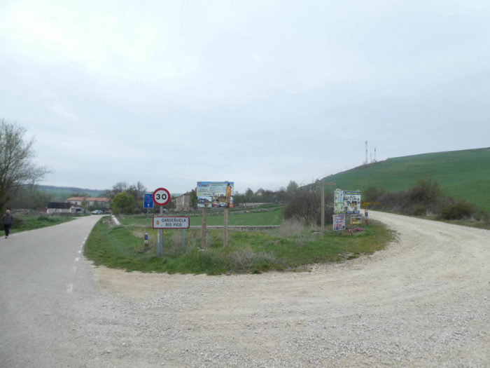 |
| It is a village in length, as are generally the villages in Spain. |
 |
 |
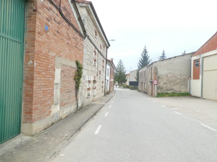
| There is here all the panoply of the villages of Castile, a mixture of stone houses, others in light construction, others in mud. There is always a church as big as the village and the indispensable “albergue de peregrinos”. |
 |
 |
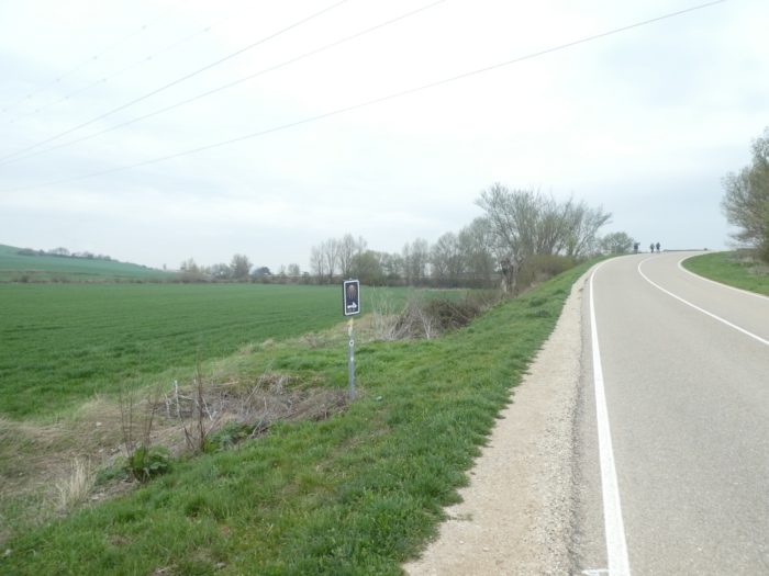
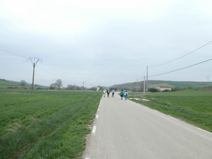
| You will probably not keep an unforgettable memory of Riopico Valley, where vehicles are much rarer than pilgrims who walk on the road. |
 |
 |
| This region seems, at first glance, more populated than many regions crossed, where the villages were very far from each other. But it remains a fairly empty country, where the population does not crowd the streets. Here, only the road brings people together. |
 |
 |
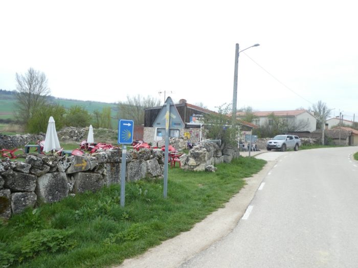
| The village of Orbaneja Riopico is just next door, a little further down the road. |
 |
 |
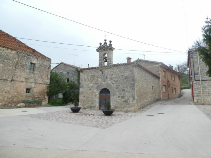
| The village is quite similar to the previous one. The massive church at the top of the village dates from the XVIth century. These are small villages, with less than 350 inhabitants. |
 |
 |
| In the middle of the village stands the hermitage of the Inmaculada, a very beautiful Romanesque building, the date of construction of which cannot be specified. |
 |
 |
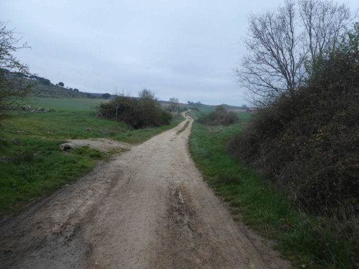
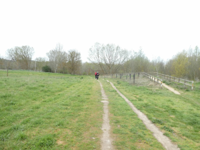
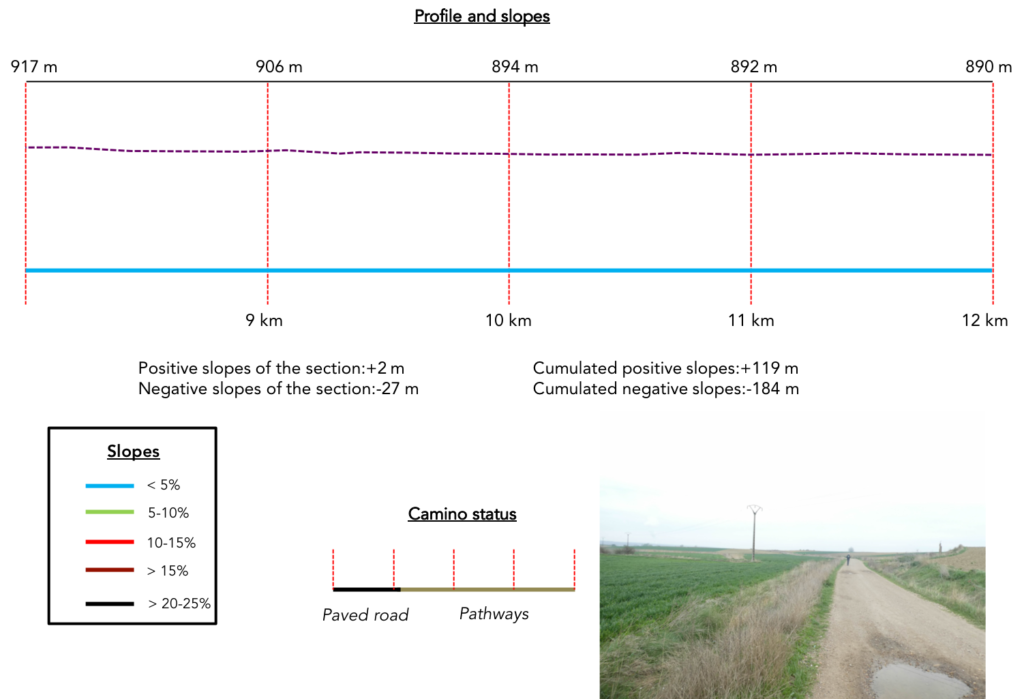
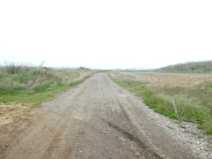
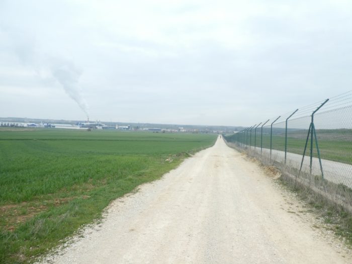
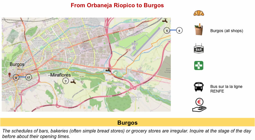
Section 3: While passing by Burgos airport.
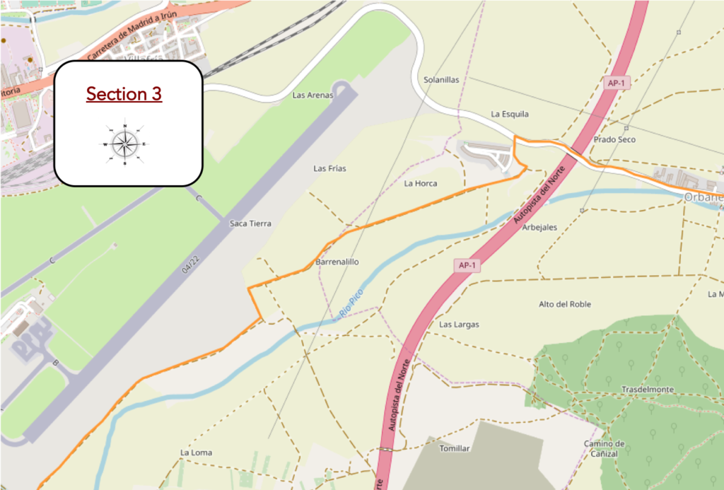
Overview of the difficulties of the route : course without any difficulty.
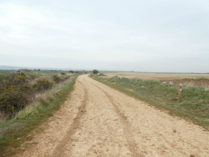
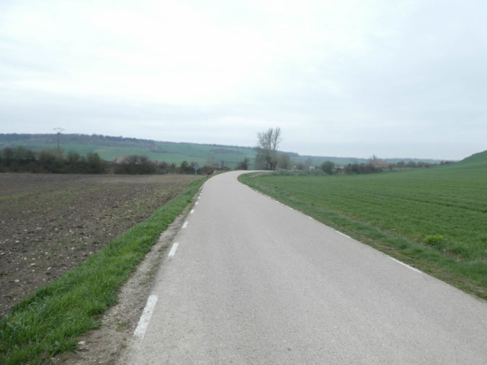
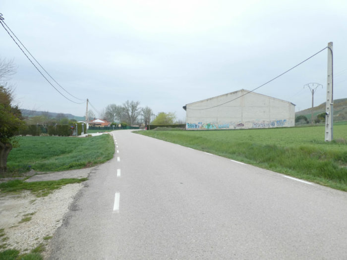
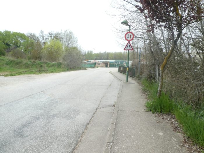
| The road leaves the village and goes towards the large motorway junction of Burgos. Here, the landscape has become dreadfully banal, a kind of gray zone, an area to which it is difficult to attach a label. |
 |
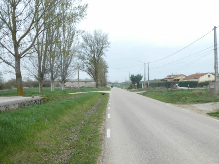 |
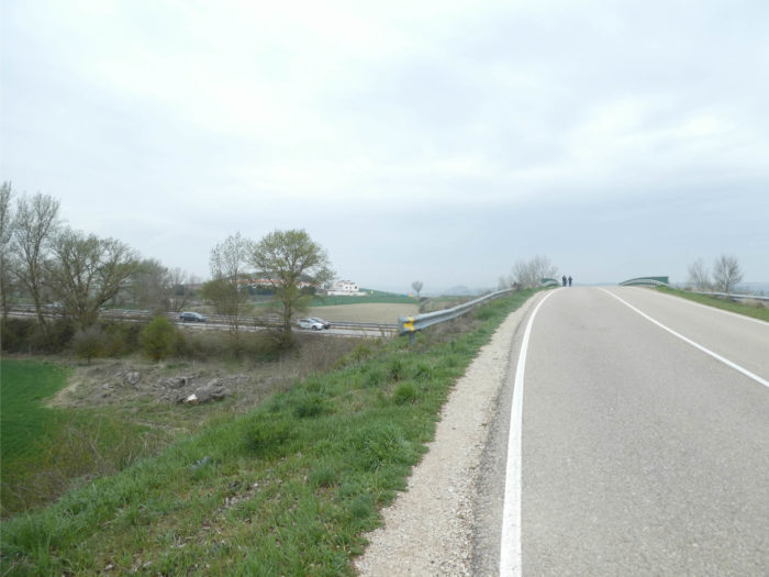
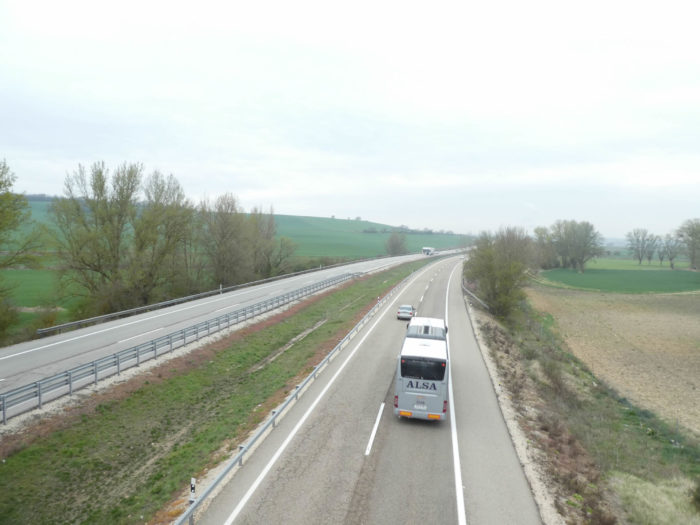
| The road runs over AP-1, the Autopista del Norte, the big highway that goes down from the French border to Burgos. It is notorious to count the highways that crisscross the country, close to Santiago Track, and which are, at least this season, almost empty of cars and trucks. |
 |
 |
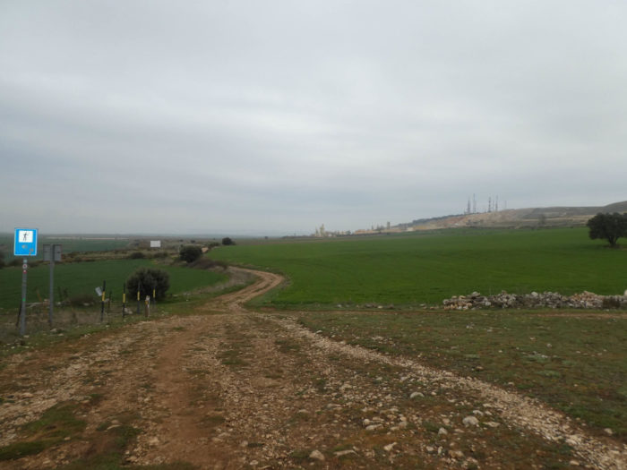
| The Camino then bypasses a subdivision of new houses, then flattens on a long rectilinear in the bleak plain, in the middle of wheat fields. The country here is neither charm nor beauty. |
 |
 |
| Further ahead, it is a long straight line of gloom that awaits you, a zone as dead as it is insipid, a real no mans ‘land where short brush and loneliness reign. |
 |
 |
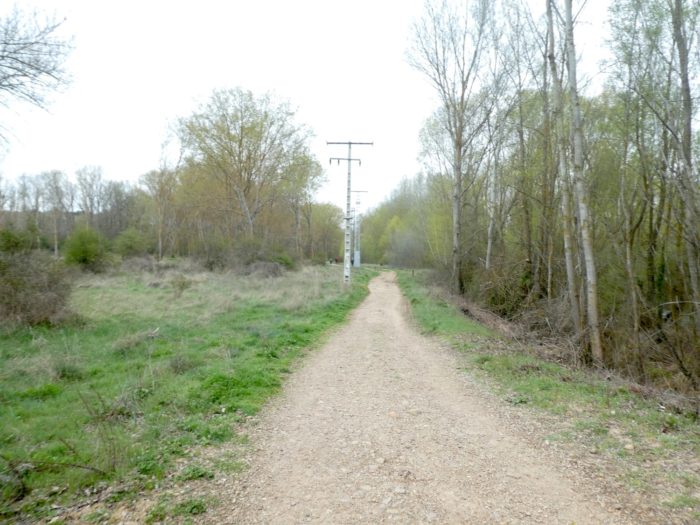
| A little further on, the wide pathway turns and heads towards the outskirts of the airport. But that doesn’t add anything new to the ambient decor. |
 |
 |
| The pathway then runs forever along the protective barriers of the airport. We will not say that this part of the course is the most exciting of the day. It’s even boring, daunting as possible. Let’s face it, it’s pretty grim. The outskirts of airports are rarely exciting. |
 |
 |
| During the big half-hour spent near the airport, we did not see any planes taking off or landing. There was only one small plane at the terminal. This airport was formerly a military airport, then a club airport. It was opened to commercial flights about ten years ago. Apparently, people come by bus to Burgos, because for the train it is also another matter. Burgos-Rosa de Lima train station is 5 kilometers away from the city center. |
 |
 |
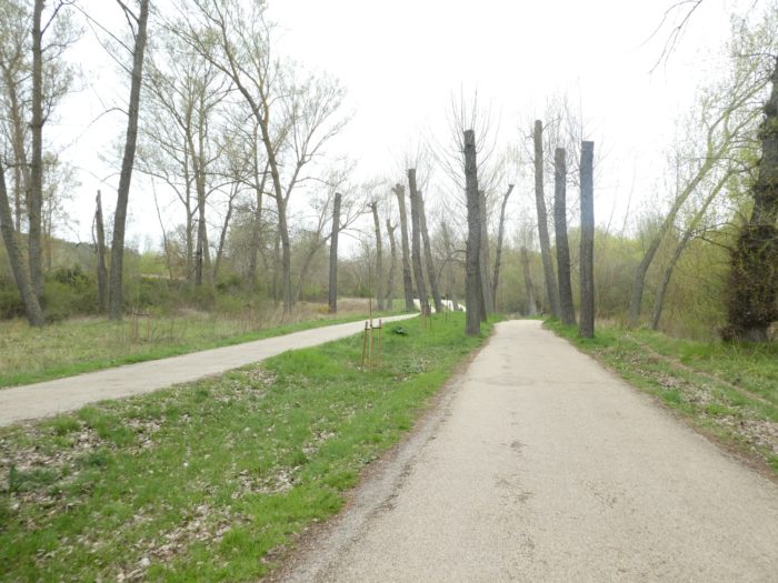
| Further afield, the pathway, while skirting the barriers, is gradually moving towards the large suburbs of the city. Nevertheless, you’ll be glad to leave this distressing banality, to have something more positive to see. |
 |
 |
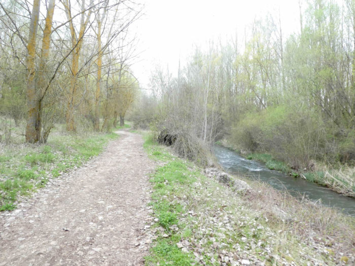
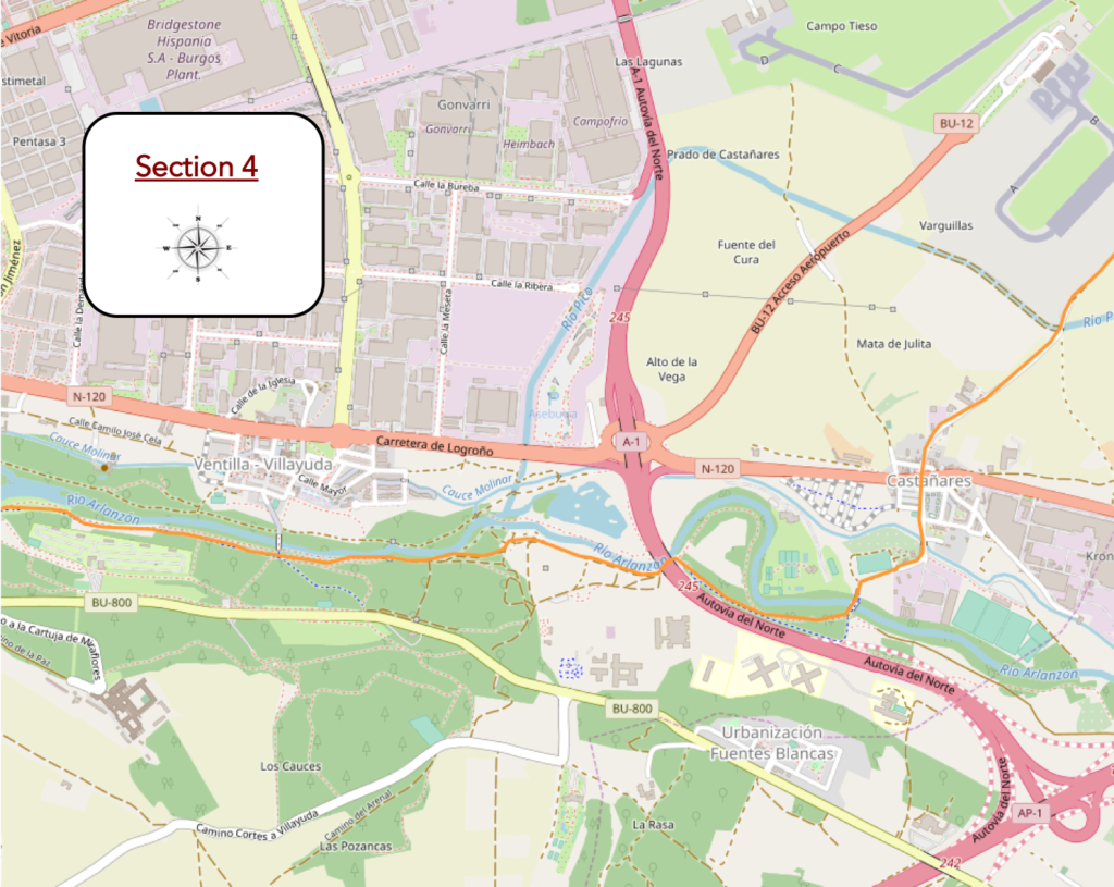
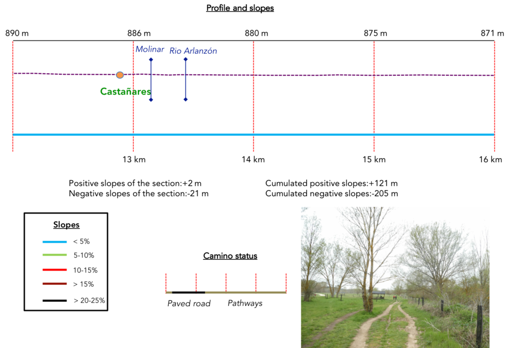
Section 4: Along the beautiful Rio Arlanzón.
Overview of the difficulties of the route: course without any difficulty.
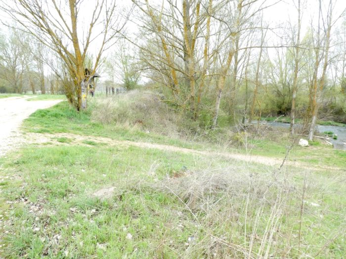
| Soon the Camino crosses the little Rio Pico brook, which owes its name to the small valley where you traveled along. You are ready to return to civilization, at least to that of the industrial zone. |
 |
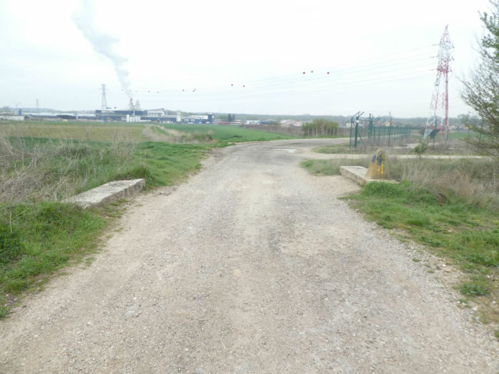 |
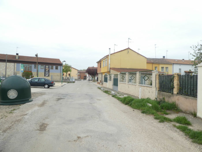
| At the exit of the meager industrial zone, the Camino reaches Castañares, a suburb of Burgos. |
 |
 |
| Shortly after, it crosses the Molinar stream, which has a little more water than the Rio Pico. |
 |
 |
| Still a small passage without pleasure… |
 |
 |
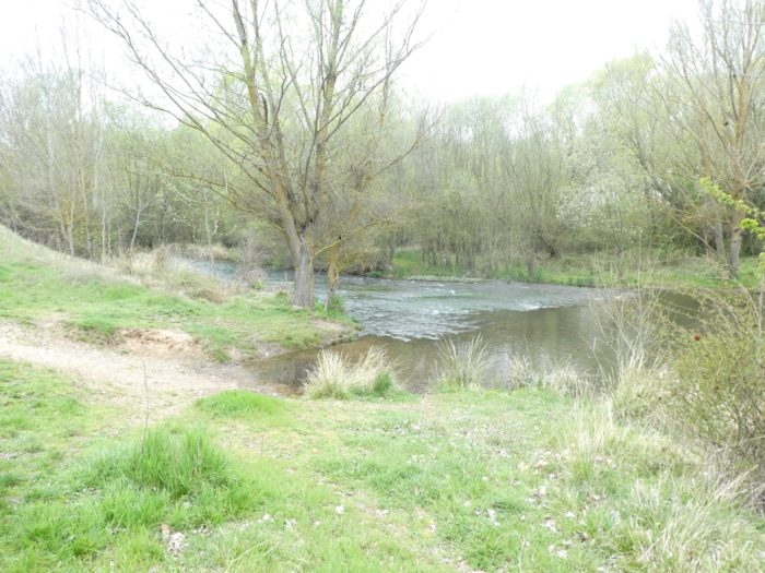
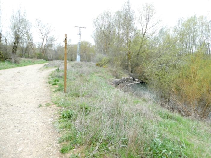
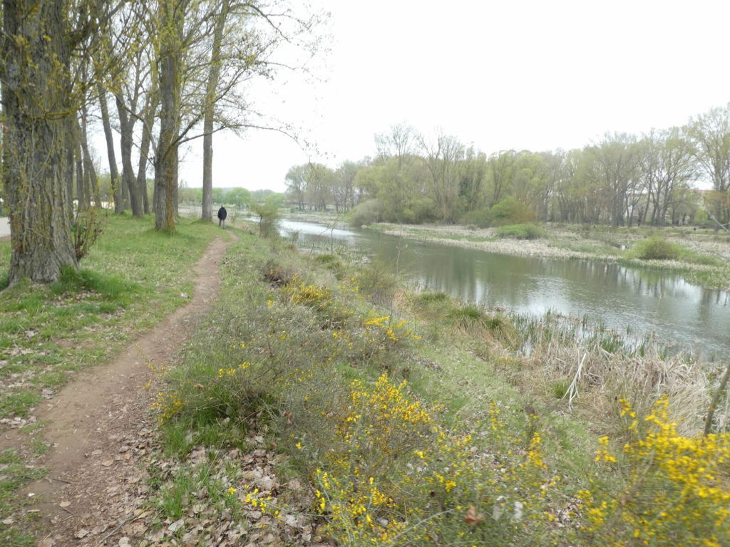
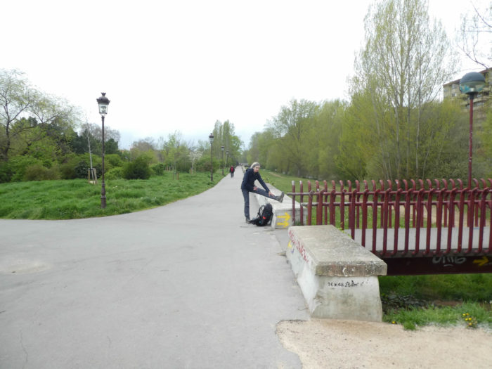
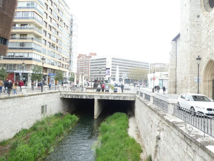
… and then a real pathway reaches a park along Arlanzón River that will take you to downtown

| You’ll walk now along the magnificent Rio Arlanzón, which here extends its meanders under the black poplars. Rivers are often needed for cities to be beautiful. |
 |
 |
| Shortly after, the pathway makes a small pleasure trip in the company of the highway ramp. You cannot ask everything, but poplars are so hospitable here, like big umbrellas. |
 |
 |
| Further ahead, the pathway leaves the highway and you are back to the river. |
 |
 |
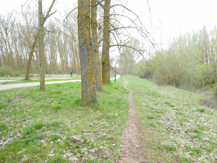
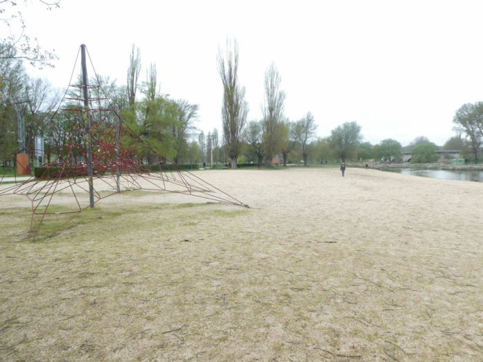
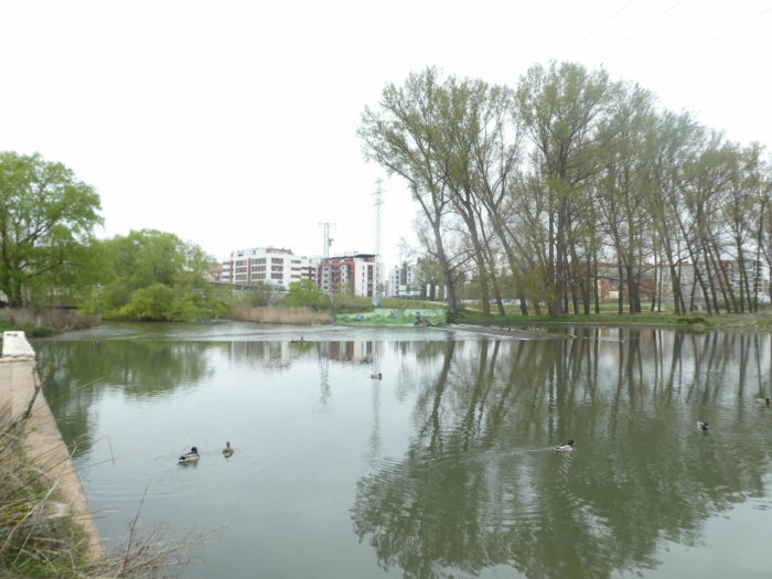
| From here, the space opens with small parallel tracks that crisscross the lawns along the river. You may feel that there are only pilgrims here. No, this park is the lungs of the city, and joggers and moms with strollers roam here all day long. |
 |
 |
| How lucky are Burgos people to come and relax here at their leisure. You can choose the path as you please, go closer to the water… |
 |
 |
| … or prefer pathways close to bike paths. And all this happiness under the big black poplars covered with yellowed lichen that give you the direction of the north. |
 |
 |
Peace and harmony haunt these exceptional places.
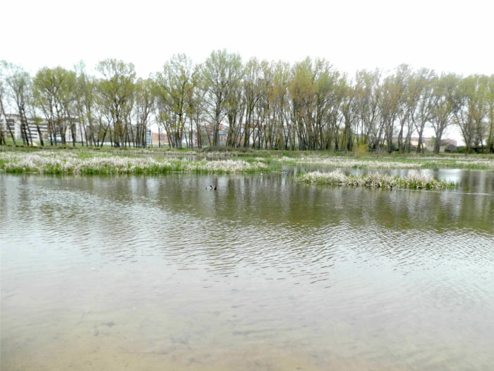
| A little further, Rio Arlanzón takes a little more ease near a shore, under the large black poplars and big ash trees that have already recovered their plumage a little. They have probably planted these ash trees here to change a little of the rigor of the black poplars that cover all of northern Spain to this point. |
 |
 |
Section 5: To reach downtown.
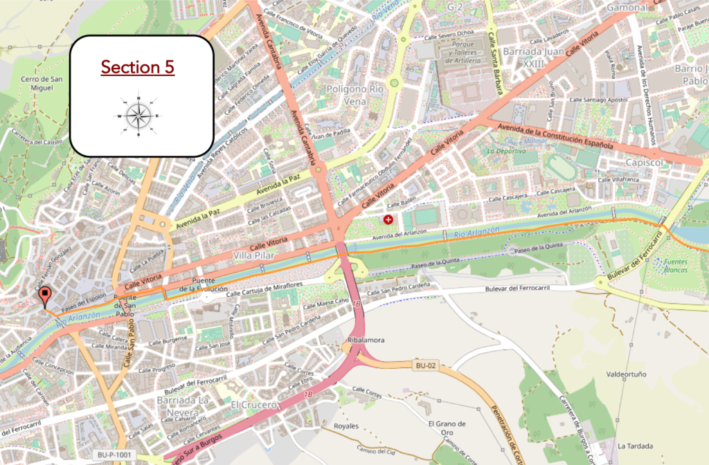
Overview of the difficulties of the route: course without any difficulty.
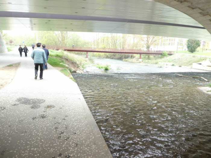
| Further ahead, the pathway passes under the BU-11, the national highway that goes to Madrid, and continues under the black poplars along the river. |
 |
 |
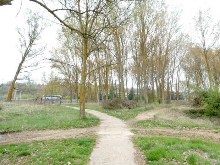
| Even if here there are not many signs of the way, you do not get lost, just follow the river. |
 |
 |
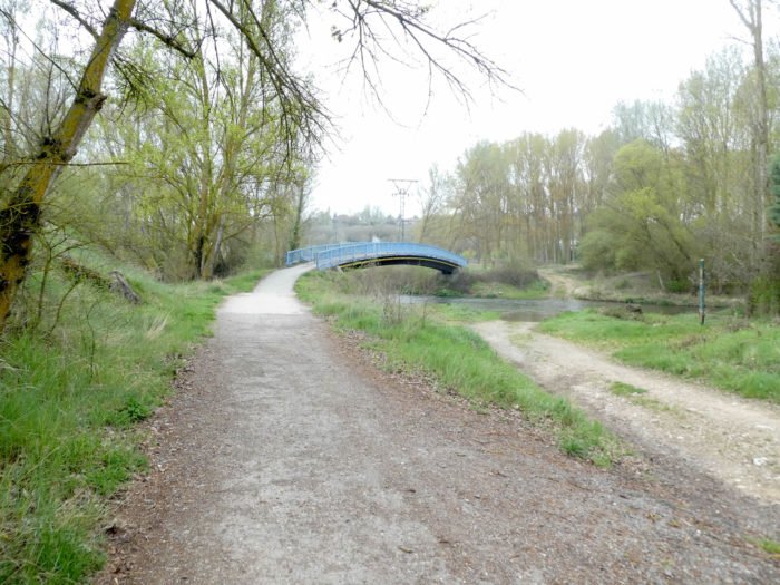
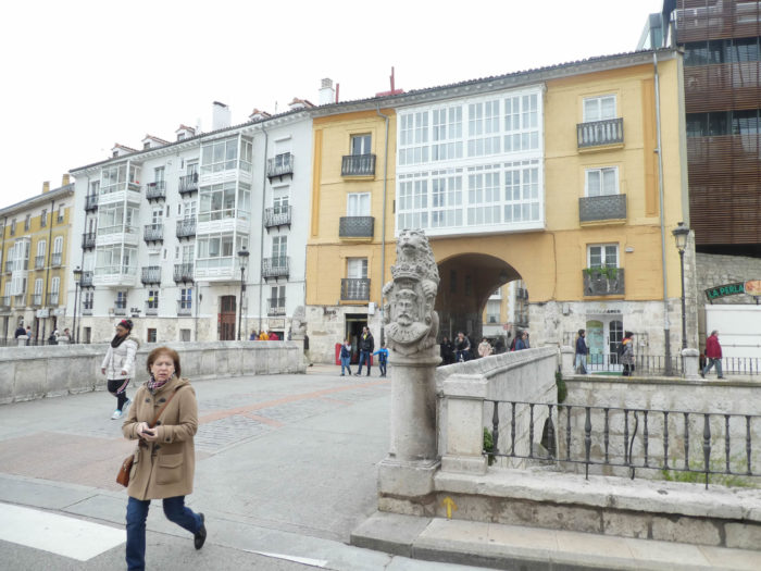
| There is sometimes a bridge that crosses the river because the river cuts the city in two. |
 |
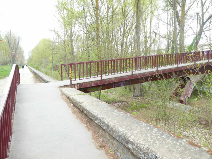 |
| When you’ll reach the stone bridge called Puente de la Evolución, you’ll soon cross the river. |
 |
 |
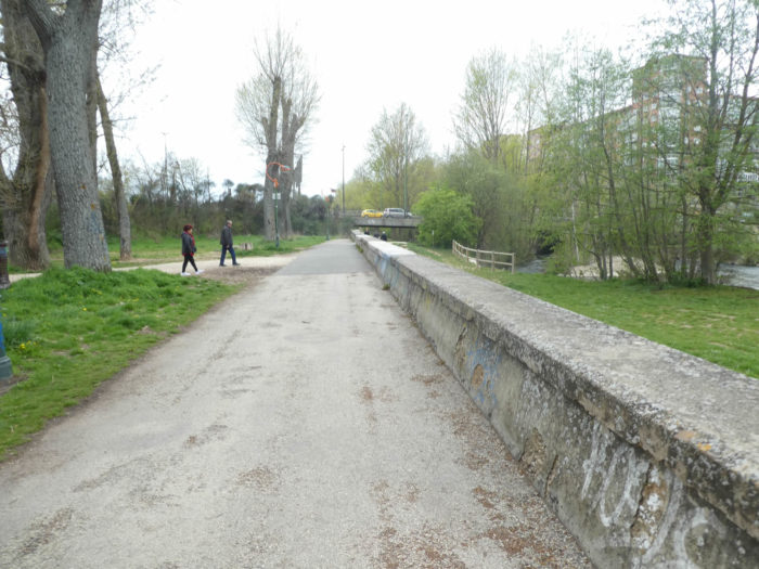
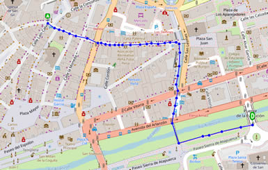
Here is a small map that will allow you to reach the city center. The course is marked.
| Still a bit of a stroll along the river, which will have pleased you no doubt, and the Camino then finds the bridge, marked with yellow signs, to go downtown. |
 |
 |
| Just follow the yellow arrows. The Camino follows the boulevards towards the city center. |
 |
 |
| The yellow arrows are there to show you the way. But, with the number of pilgrims circulating here, you will not get lost. |
 |
 |
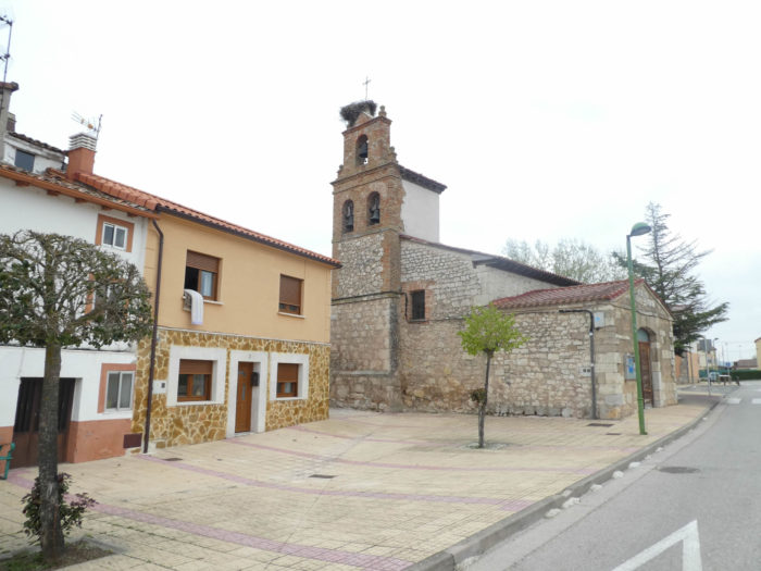
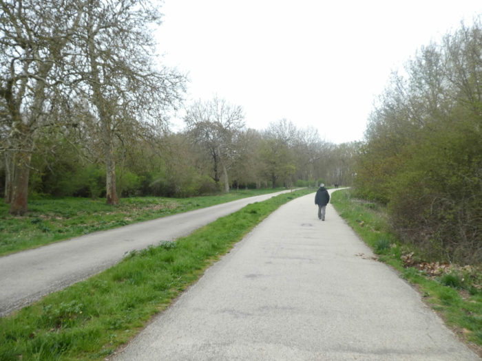
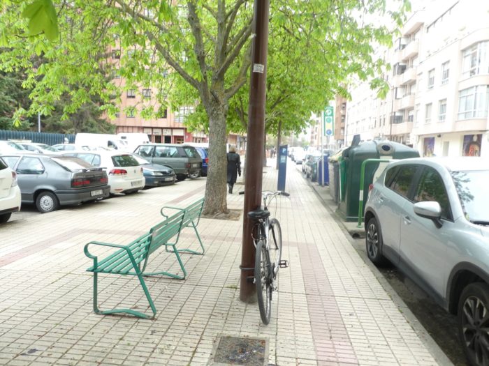
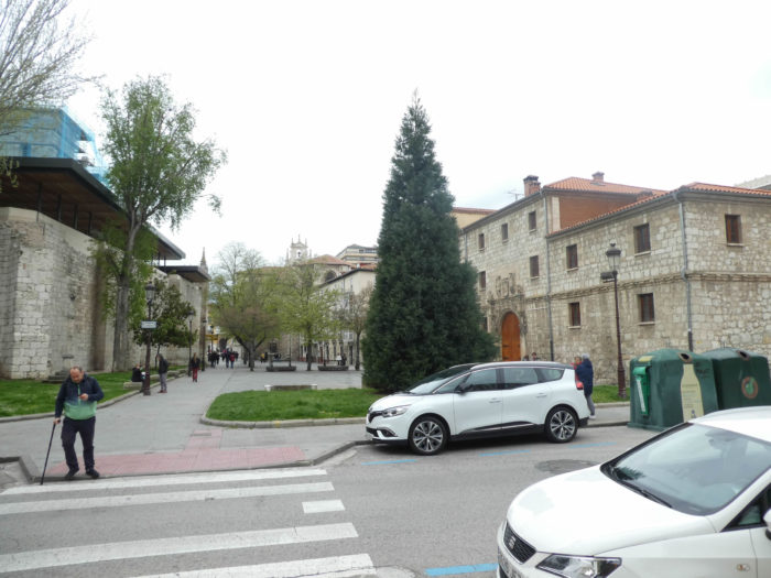
| The Camino runs along the boulevards towards the city center. It then arrives around Plaza San Juan, near the San Juan Monastery. This monastery, built in the XIth century and rebuilt in the following centuries, played the role of a hospital for pilgrims and belonged to the Benedictine order. The building suffered severe destruction due to fires and wars. Fragments of the XVth century church have been preserved, as well as a XVIth century room and a cloister, which house collections of paintings. We owe the building to Lesmes, a monk from Poitiers, sanctified and then became patron of the city at the beginning of the XVIth century. |
 |
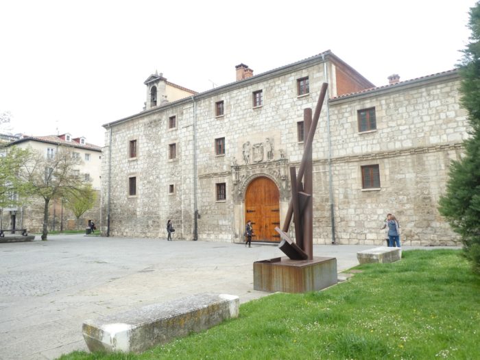 |
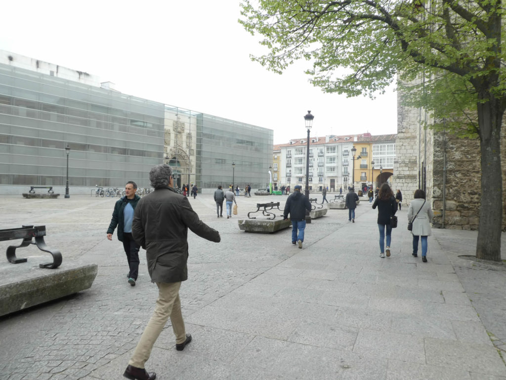
In San Juan Square now stands the Public Library of Burgos, whose origin dates back to 1871, having moved several times. Among other treasures, you find here one of the many copies of the Gutenberg Bible. It is part of the great complex of San Juan, where the construction of the old hospital for medieval pilgrims began. Of this hospital only remains a Gothic door, the only element preserved, of the primitive hospital of San Juan after the fire of 1949. Today, a glass facade is added to it. Maybe one day soon, when you pass by here, its facade will be refurbished
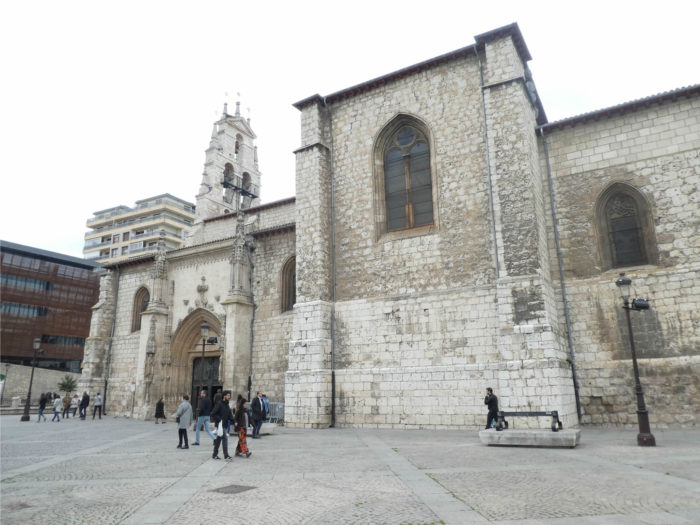
| The San Lesmes church faces the library on the square. It was built in the XVth century to house the bones of San Lesmes, the patron saint of the city, who devoted his life to caring for pilgrims. Then, it was modified according to fashions. It is filled with gold and bronze, pure baroque, as is often the case in Spain. But, we note in the church a beautiful stone pulpit, many tombs, including that of the saint. Lesmes was a French Benedictine monk called to Burgos to help replace the Mozarabic liturgical rite with the new Roman liturgy. His life and work were linked to the Camino. |
 |
 |
| At the end of the square, the Camino passes under the Arc San Juan and crosses the Rio Vena. |
 |
 |
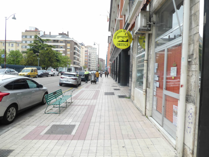
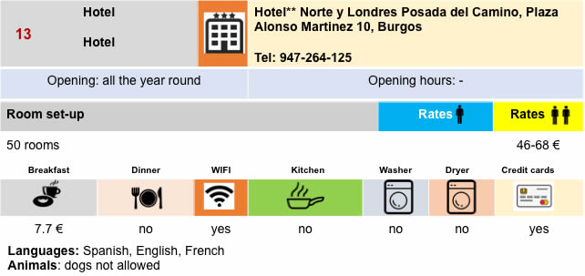
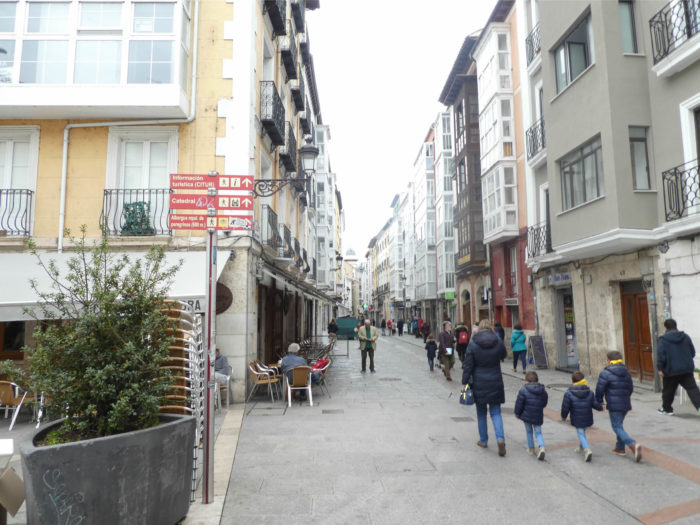
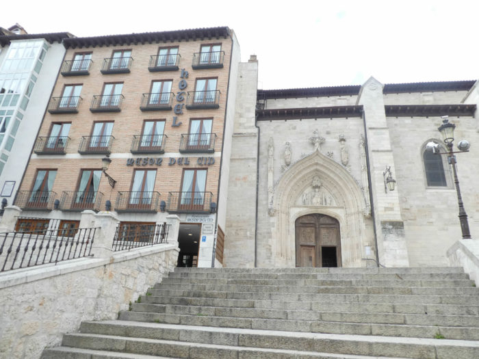
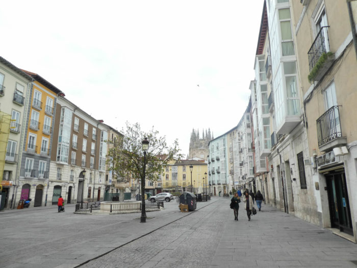
| Further on, you’ll follow the shopping street of Calle San Juan for a long time. At the end of the street, you’ll get near the Hotel Norte y Londres, near the Tourist Office, a stone’s throw from the Plaza Mayor and the Cathedral. |
 |
 |
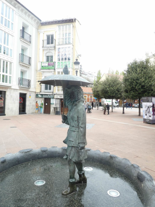
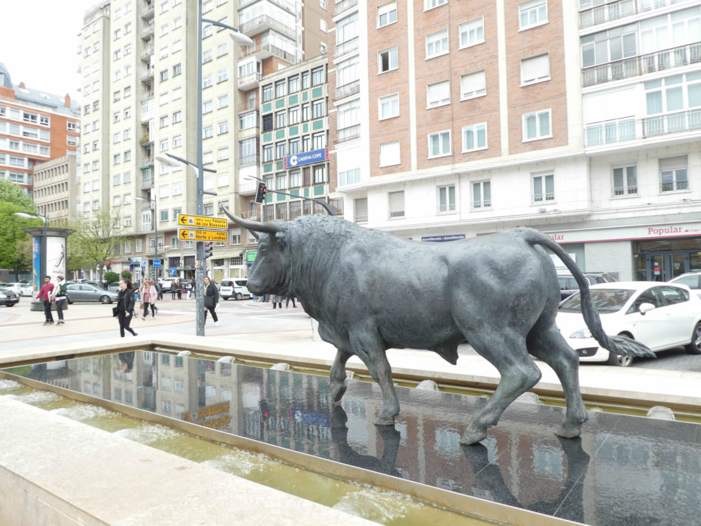
| The city is full of modern bronze statues, very realistic. It is beautiful urban sculpture, scattered all over the city. |
 |
 |
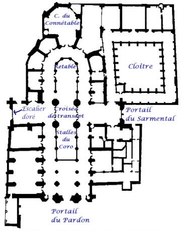
Section 6: A short tour of the cathedral and its surroundings.
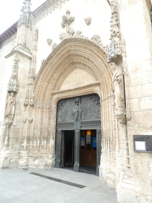
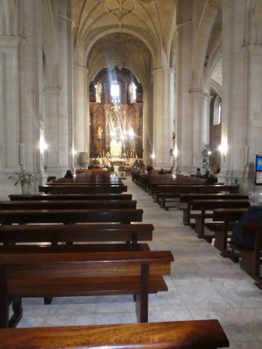
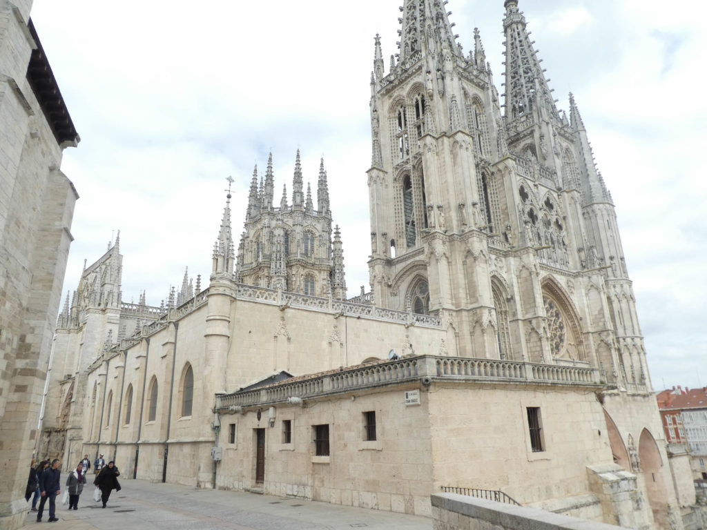
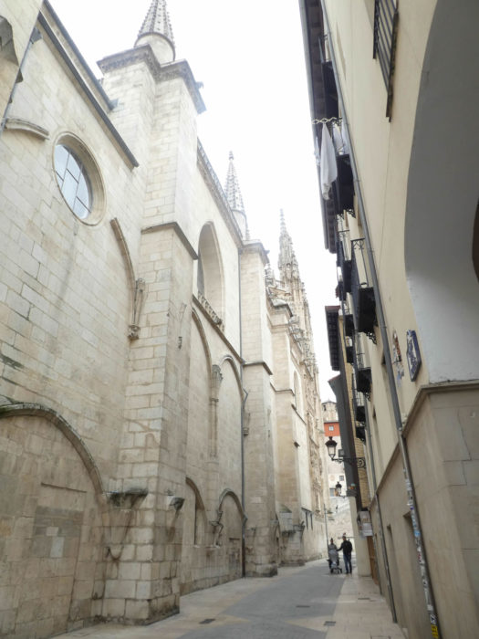
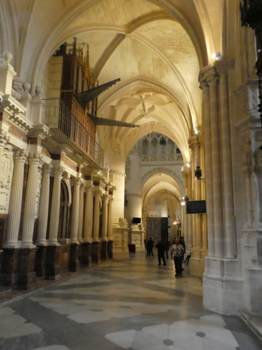
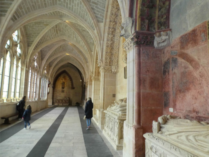
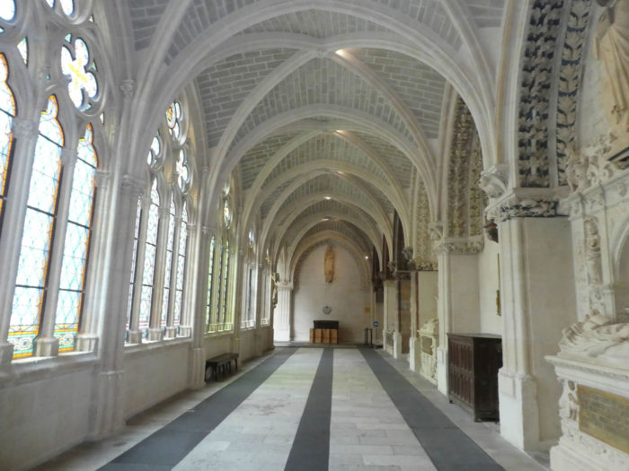
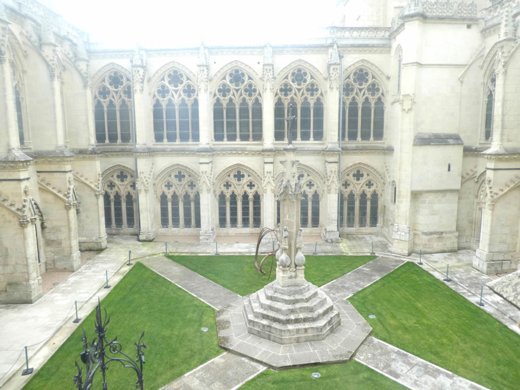
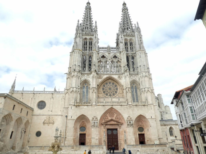
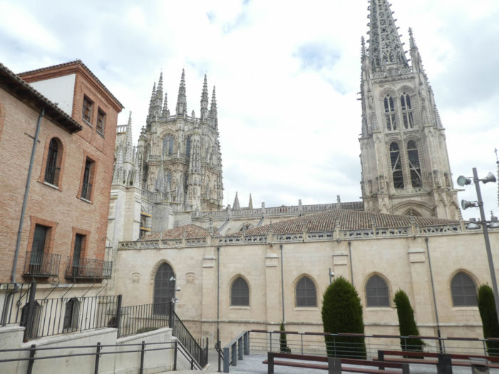
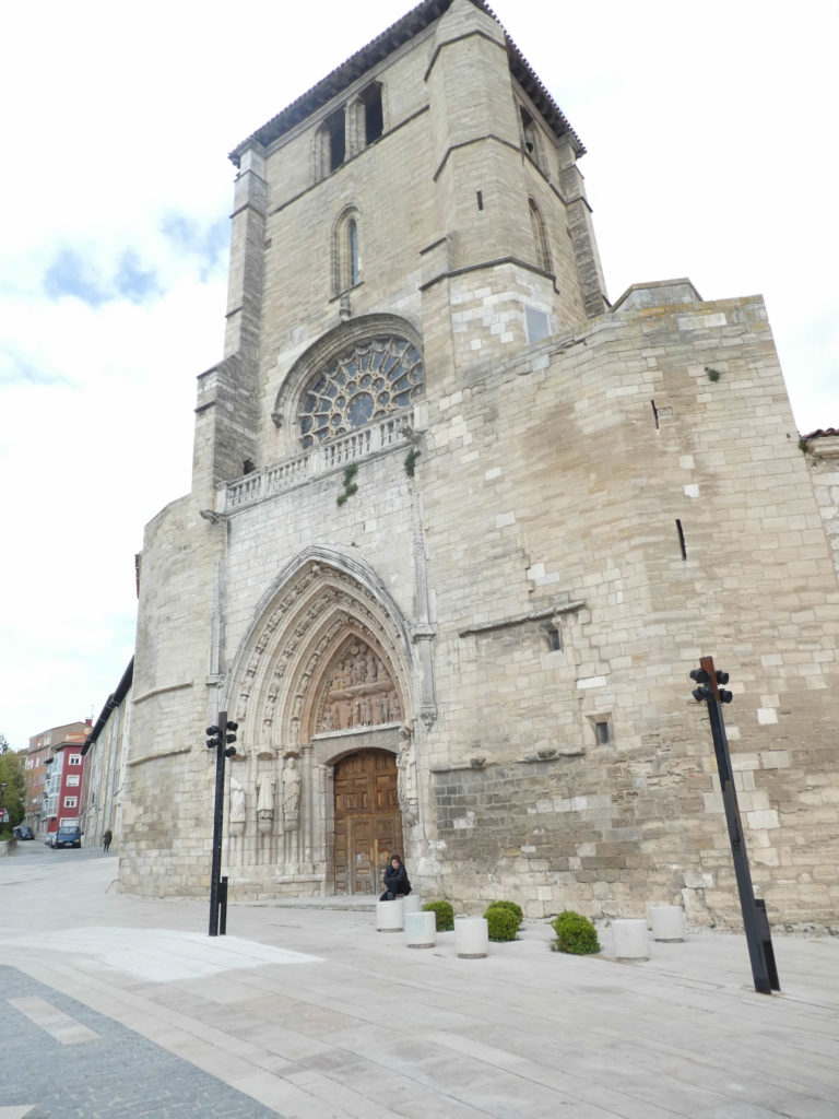
Burgos (175,000 inhabitants) is a magnificent city, with a historic center grouped around the cathedral, charming alleys around the building and those that go towards the Plaza Mayor down to the Castle of Santa Maria, near the Rio Arlanzón. Give honor where honor is due. Let’s start with the majestic Sainte Marie Cathedral. In many places the view opens onto the cathedral. Walking around the cathedral you can see how the architects used the irregularity of the terrain to erect the magnificent cloister on several levels, the first floor of the cloister being on one level with the church. The Cathedral of Santa María de Burgos is dedicated to the Virgin Mary, and is therefore sometimes called Our Lady of Burgos. It is a masterpiece that was declared a national monument in 1885 and designated as a UNESCO World Heritage Site in 1984. The cathedral is predominantly Gothic, but has been embellished in many different styles (Renaissance and Baroque) through the centuries.
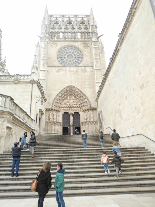
| You enter the church through the Gate of Sarmental (portal of the oath), with arches and a magnificent tympanum dating back to the beginning of construction. It is Gothic, completed at the beginning of the XIIth century. |
 |
 |
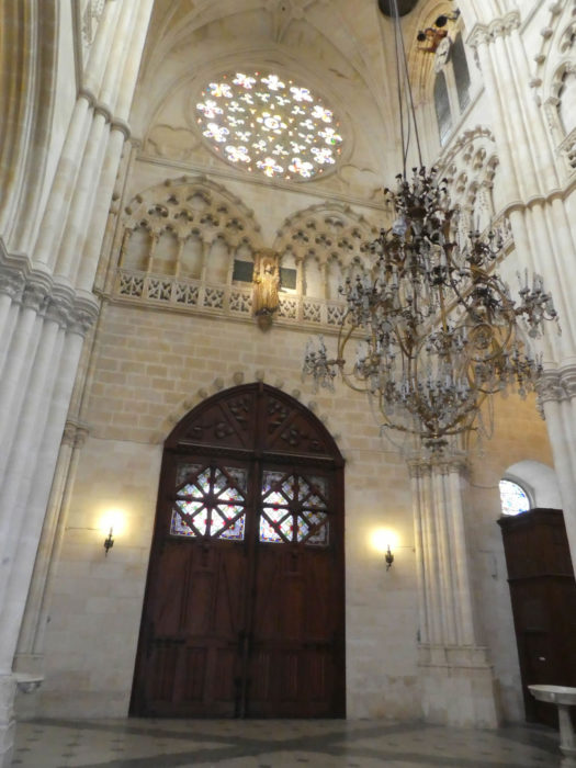
Saint Mary’s Cathedral is a World Heritage Site. It is the third largest cathedral in Spain, after Toledo and Seville. The first stone was laid at the beginning of the XIIIth century, by Bishop Don Muricio, returning from France, impressed by the Gothic constructions there. Remarkably, the church was in use nine years after construction began, when the apse chapel was completed and the bulk of the nave and aisle work quickly completed. Between the second half of the XIIIth century and the beginning of the XIVth century, the chapels of the side aisles were completed and a new cloister was built. In the XVth century, a section of new work was started again by raising the arrows of the facade, the Chapel of the Constable. The style then changed a little, inspired by Flanders and Germany. This is the period of flamboyant Gothic.
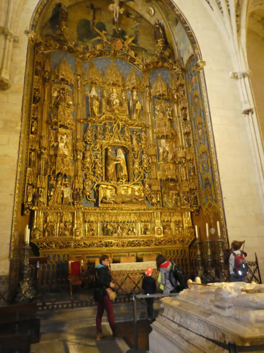
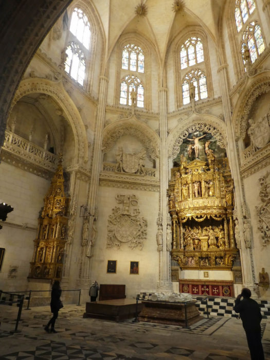
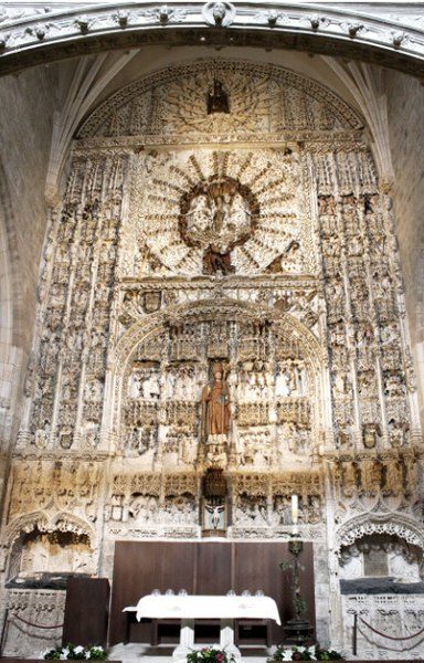
Therefore, although the style of the cathedral is Gothic, the interior has Renaissance and Baroque decorations. The last major works, including the sacristy, date from the XVIIIth century. You can spend a good day contemplating all the wonders that can be found there. There is a total of 21 chapels. The most popular are the Capilla de Santa Tecla, with its extraordinary ceiling, and the Constable’s Chapel. Not to mention the tomb of El Cid and Chimenea.
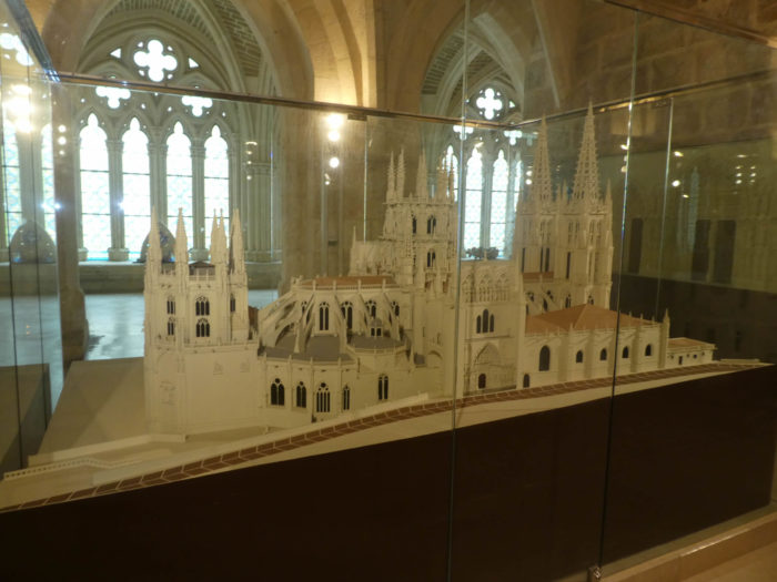
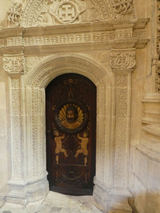
In most cathedrals, the main facade traditionally faces west. Here, this is not the case, the cathedral of Burgos having been built at an angle. Tourists must enter through the east gate, which remains a curious entrance. Inside the cloister, models show the complete work, as the building is so imposing that it is difficult to take a complete image.
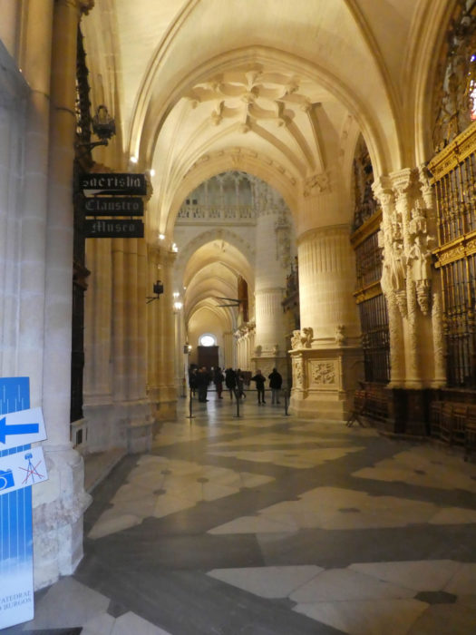
| In the side aisles, riddled with chapels, sometimes the gold and bronzes are gleaming, but some are soberer. |
 |
 |
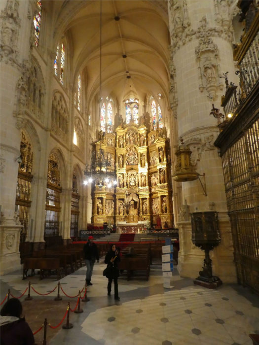
| The nave is very high, quite bare, which is never the case for the altars which shine in gold and bronze. On the side aisles, the chapels are often enclosed by magnificent gates. |
 |
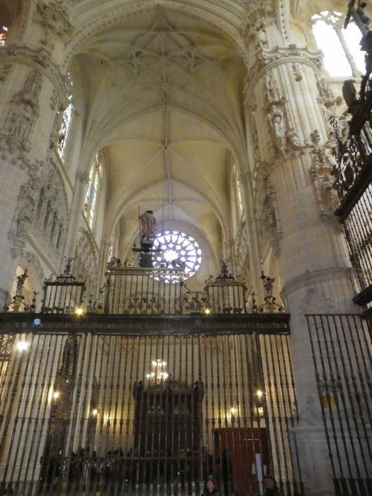 |
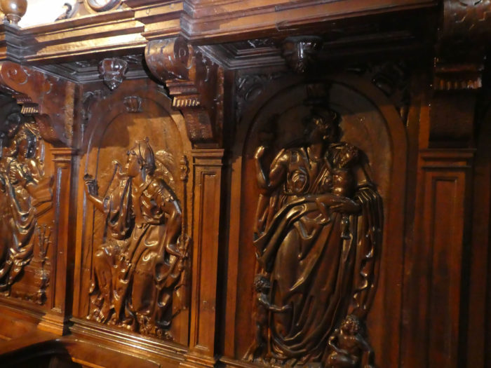
| Near the choir stands an extraordinary set of walnut stalls which tell the Old and New Testaments or present mythological subjects. |
 |
 |
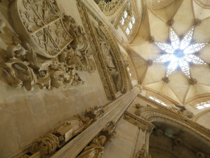
| Splendid starry lanterns are nestled in the window or in the chapels, more than 50 meters above the ground. |
 |
 |
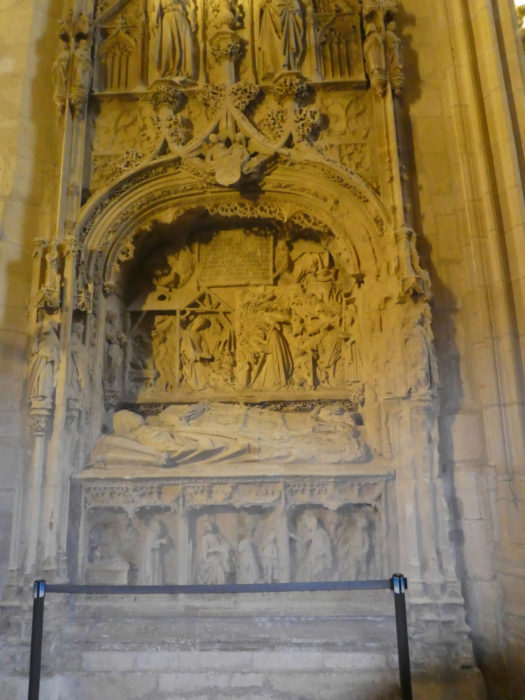
| It is here that under the slabs are buried the Cid and his wife Chimenea. Le Cid is not just a French literary work, it is a true national hero, as we said in the introduction. |
 |
 |
| The sacristy and the cloister are close to the altar. The architecture is quite complex in this building. |
 |
 |
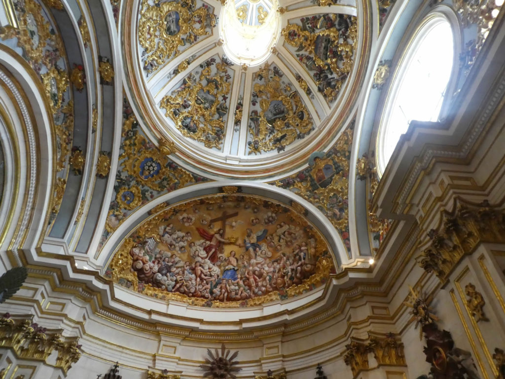
Leaving the church for the cloister you will pass the sacristy and its splendid ceiling. You could imagine yourself in the Sistine Chapel, but more modest.
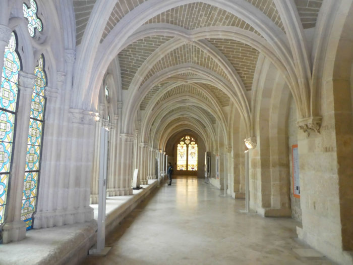
| The cloister is made up of clear Gothic galleries, built in the XIVth century, with a large number of decorative objects, very well displayed. |
 |
 |
| The memory of the Cid is omnipresent in Burgos. |
 |
 |
It is a majestic two-level cloister.
| Strolling under these centuries-old warheads, in the labyrinth of the cloister, is absolutely serene… |
 |
 |
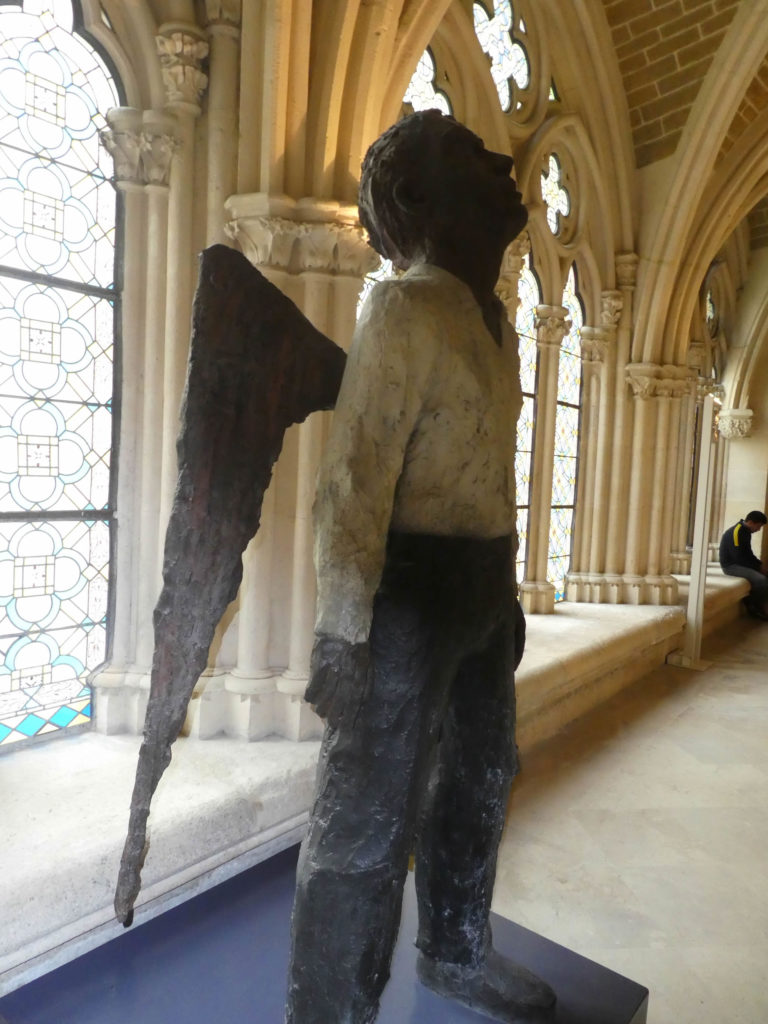
…to find yourself face to face with the angel, a great moment of emotion.
| Leaving the church, you will have a better idea of this incredible building as a whole, reaching the other portal, the main portal, not accessible to the public. The most impressive entrance is the Puerta de la Coronería (or Puerta de los Apóstoles), the portal of the north transept, crowned with two spires. The octagonal spiers are of German influence, in the flamboyant Gothic style, stand 84 meters high, richly surrounded by a sea of equally intricate spiers. |
 |
 |
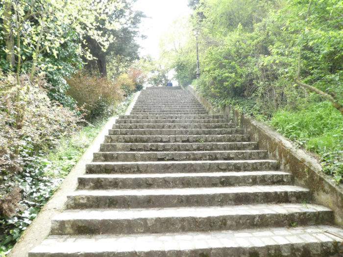
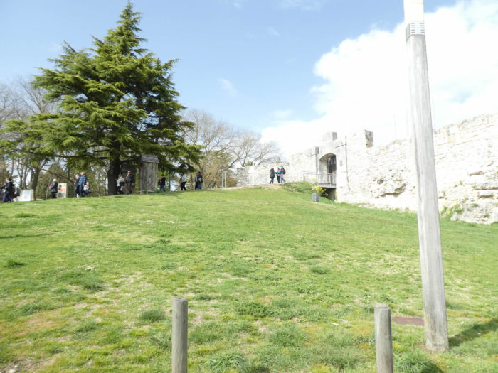
| From behind the church, you can now slope up to the ruins of the castle on the hill. You will pass near the Hotel du Cid, which adjoins the parish of San Nicolás de Bari.
San Nicolás de Bari, who lived in the IIIth century, is known as Saint Nicholas of Myra, because it is the city in Turkey where he was bishop and died. He is called Saint Nicholas of Bari because when the Muslims conquered Turkey, Roman Catholics secretly moved his relics to the city of Bari, Italy. A legend tells how, during a terrible famine, a malevolent butcher lured three little boys to his house, where he killed them, placing their remains in a barrel of brine to cure them, planning to sell them as ham. Saint Nicholas, visiting the area to care for the starving, resuscitated the three boys through his prayers. This is the same St. Nicholas that the Dutch settlers of New Amsterdam (now New York) made their patron saint as Sinter Klaus, who anglicized himself as Santa Klaus, the Santa Claus. |
 |
 |
The Church of San Nicolás de Bari is best known for having one of the largest altarpieces in Spain, the only one carved in limestone. Since the Church of San Esteban above was turned into a museum, it serves as the seat of the parish of San Esteban.
Wikipedia Creative Commpns ; Auteur Aerocap
Just above stands the church of San Esteban (St Etienne), whose existence dates back to the XIIth century. The church of Saint Etienne is sober on the outside, with however a rather beautiful tympanum and a luminous rose window. Located near the castle, it has suffered significant damage over the centuries. Burgos erected an Altarpiece Museum here in order to preserve and restore the heritage of abandoned churches or those in the process of ruin.
| Stairs then climb to the castle on the hill. Sloping up, you will have a beautiful view of the entire cathedral and a very small part of the city, which overlooks the river. |
 |
|
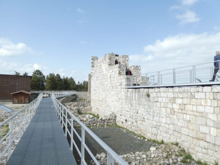
| Not much remains of the castle, although the town has made an educational effort to present the town’s history. The castle which had many Moorish aspects was on the hill, 75 meters higher than the town. It was for a long time a major fortification of the kings of Castile. But when the Habsburgs arrived, the castle lost its status as a royal residence, then its feathers when, in 1813, the French who occupied the city, destroyed the castle with explosives. |
 |
 |

There are still two churches that pilgrims and tourists hardly visit, because they are off-center. These are the Church of San Gil Abad and the Monastery of San Francisco, a Franciscan monastery of which only a few ruins remain.
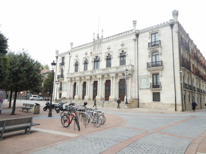
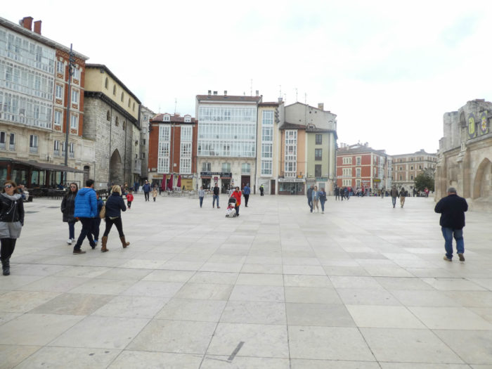
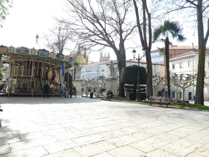
You will have plenty of time to explore in detail the charming little streets and the beautiful squares of the city center, including the Plaza de Santo Domingo, the Plaza de la Libertad or the Plaza del Moi Cid. The Tourist Office will provide you with a map of the city and the main sights. There are about twenty churches in the city. But, if you are pressed for time, like us sometimes, you have to go to the Plaza Mayor, the big square of the city. The Plaza Mayor was the original Mercado Menor (lower market square), dating back to the XVIth century, when merchants and craftsmen descended from the Castillo to set up their carts near the Puerta de las Carretas. The construction of the neo-classic town hall began at the end of the XVIIth century, on what was the gate of the carts. Its two floors are surmounted by a balustrade bearing the coat of arms of the city and two towers at the ends, each with a different clock, surmounted by spires. The building you see today was inaugurated in 1791. |
 |
 |
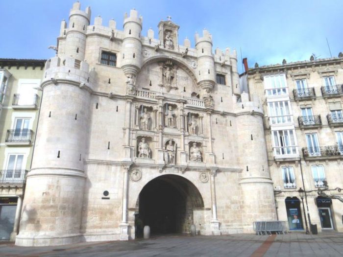
| A little below the square, near the river, stands the Arch of Santa Maria, one of the 12 medieval gates that the city had in the Middle Ages, once made it the main gate of the city. It was rebuilt under Charles V in the XVIth century, designed as a large triumphal arch in white limestone. In the main niches are the important figures in the history of the city and of Castile. Here, a beautiful, very busy promenade overlooks the river. |
 |
 |
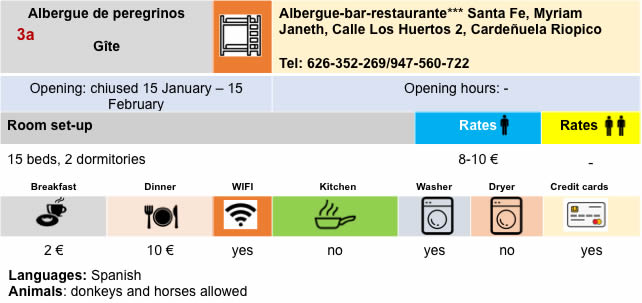
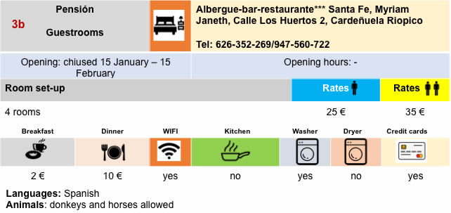
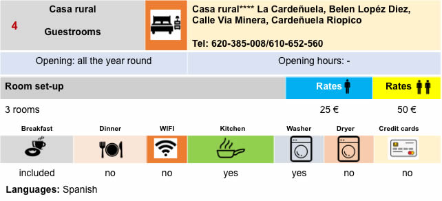
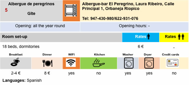
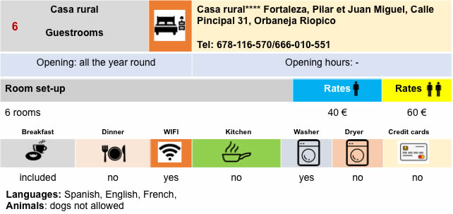
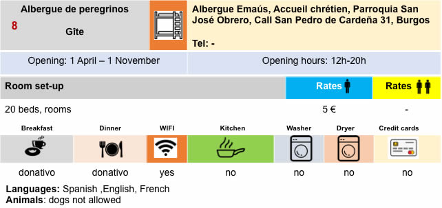
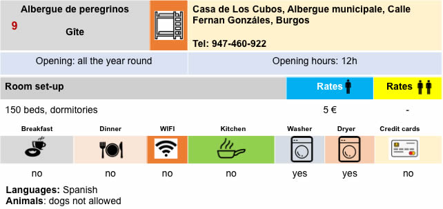
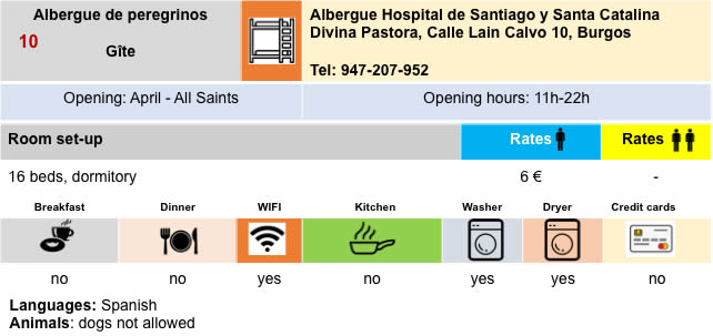
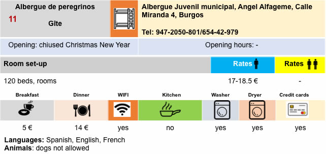
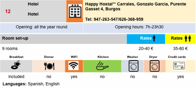
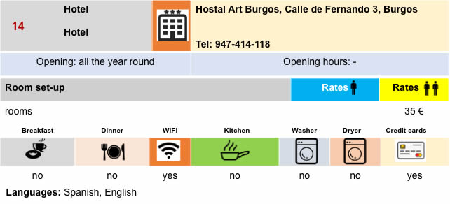
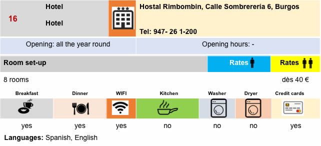
Lodging
Feel free to add comments. This is often how you move up the Google hierarchy, and how more pilgrims will have access to the site.
|
 |
Next stage : Stage 13: From Burgos to Hornillas del Camino |
|
 |
Back to menu |