Pilgrims are already like horses smelling the stable
DIDIER HEUMANN, ANDREAS PAPASAVVAS
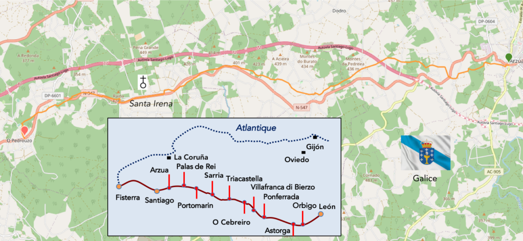
We divided the course into several sections to make it easier to see. For each section, the maps show the course, the slopes found on the course, and the state of the Camino. The courses were drawn on the “Wikilocs” platform. Today, it is no longer necessary to walk around with detailed maps in your pocket or bag. If you have a mobile phone or tablet, you can easily follow routes live.
For this stage, here is the link:
https://fr.wikiloc.com/itineraires-randonnee/de-arzua-a-o-pedrouzo-par-le-camino-frances-115247105
It is obviously not the case for all pilgrims to be comfortable with reading GPS and routes on a laptop, and there are still many places in Europe without an Internet connection. Therefore, you will find soon a book on Amazon that deals with this course.
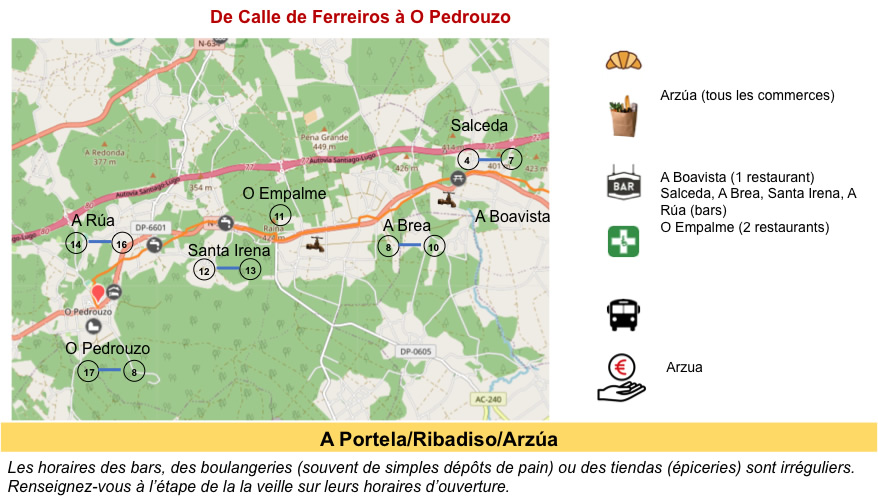
If you only want to consult lodging of the stage, go directly to the bottom of the page.
The closer the route gets to Santiago, the more the line of pilgrims intensifies. In the high season months, there are more than 1,000 per day. It buzzes everywhere, it chatters like geese in shambles. The valleys are gentler beyond Arzúa, making the final approach to Santiago a lovely walk, passing several small hamlets that stand out only for their popular Galician architecture. Increasingly, the hillsides are planted with eucalyptus, used for making furniture and paper. It’s like in Portugal or California.
The Galician oak forest is a national treasure. Its sturdy timber was used to build the mighty Spanish naval armada, and in the early XVIth century, in an effort to preserve the forest for state use, a royal decree prohibited anyone from felling the huge trees. without license. Then, in the XIXth century, eucalyptus was introduced to Spain under the mistaken belief that it would be good for construction. Eucalyptus can grow up to 13 meters in three years, much faster than local oak, making it popular as a source of pulp and firewood. In 1941, Franco introduced a law, advocating the use of eucalyptus to fuel the nascent pulp industry. These non-native species now represent almost a third of the Galician forest.
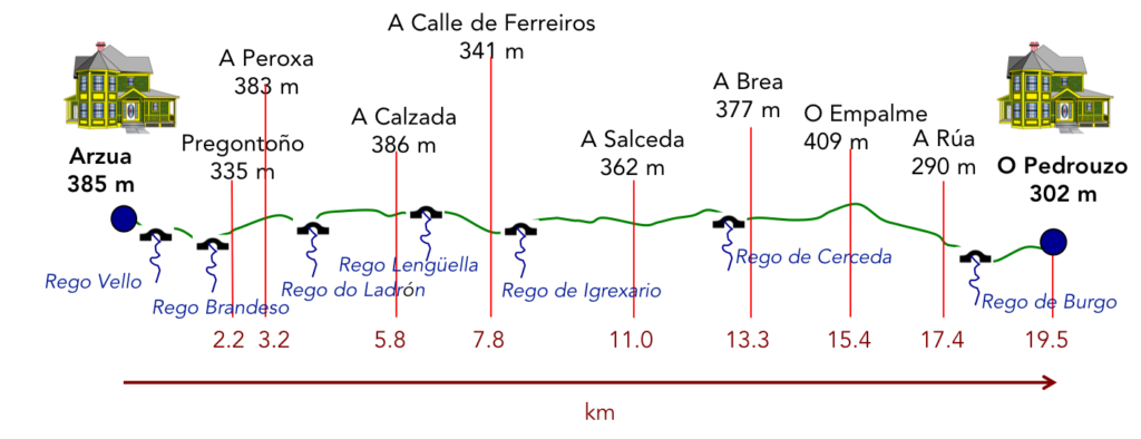
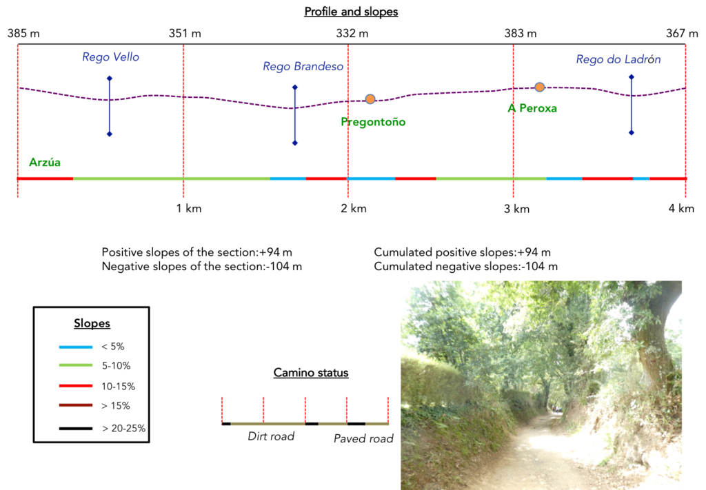
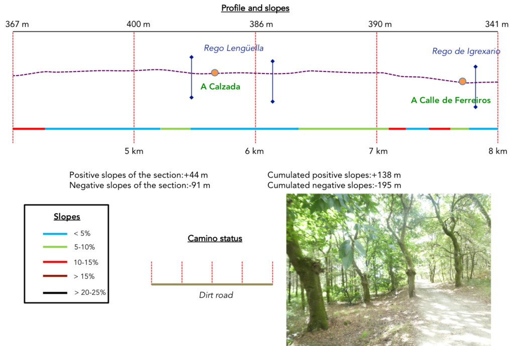
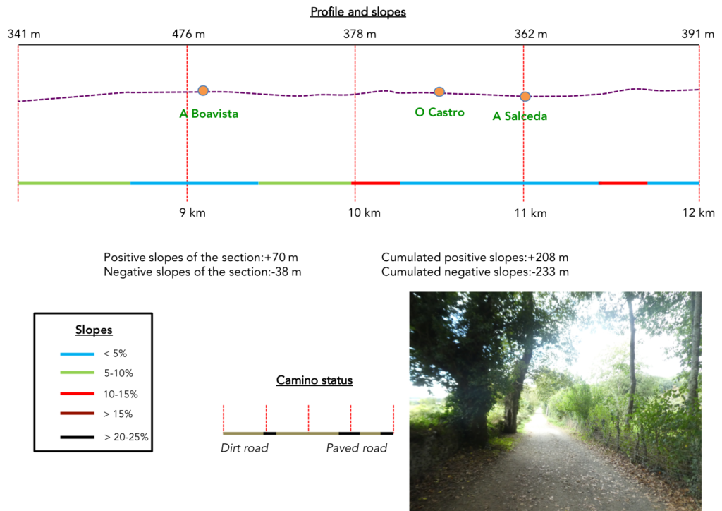
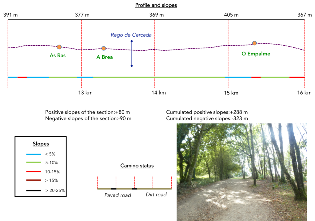
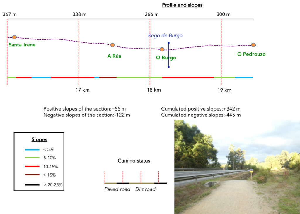
Difficulty of the course: Slope variations (+342m/-445m) are not negligible. This stage is a succession of incessant ups and downs, from one stream to another. There is nothing particular to report as a difficulty, but it is rarely flat.
 In this stage, you will most often walk on lost pathways in the woods:
- Paved roads: 4.0 km
- Dirt roads: 15.5 km
We did the route from León in the fall, in fairly good weather, unlike the first part of the route, which was done on soggy ground, mostly in sticky mud.
It is very difficult to specify with certainty the incline of the slopes, whatever the system you use.
For “real slopes” reread the mileage manual on the home page.

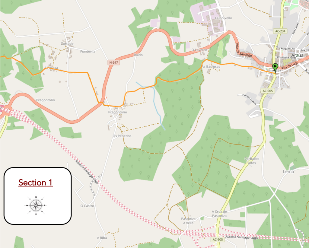
Section 1: From one small stream to another.
General overview of the difficulties of the route: ups and downs with little difference in altitude.
| For camera reasons, we cannot offer you images of the exit of Arzúa..
So, let’s resume the route when the Camino crosses the N-547 road and climbs towards the hamlet of A Paroxa. |
 |
 |
| At the level of the hamlet, the Camino leaves the paved road for the dirt road. |
 |
 |
| The pathway descends into the wood on a steep slope where small oaks proliferate. |
 |
 |
| At the bottom of a short descent, the pathway meets the discreet Rego do Ladrón stream. |
 |
 |
| Beyond the stream, it slopes up into the woods, as steeply as during the descent. |
 |
 |
| Further up, the slope fades. |
 |
 |
Section 2: Always the same chorus.

General overview of the difficulties of the route: with less substantial slopes.
| It is then a very beautiful pathway that runs through oaks and eucalyptus. The embankments are dotted with scattered bushes that provide large touches of greenery, dotted with dark green broom that undulates, waxed with light. |
 |
 |
| Shortly after, the pathway crosses a small side road and continues straight into the woods. The eucalyptus trees, when there are any, are aligned, military, as in a parade ground. |
 |
 |
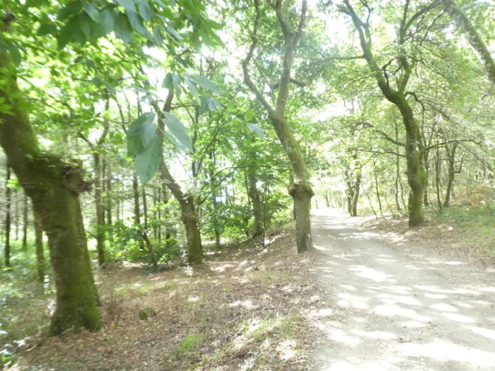
| When the gaze is lost behind the trees, it is only dense woods without human presence. Here, the forest is an impassive theater where only the footsteps of pilgrims resonate, crunching on the small pebbles on the pathway. |
 |
 |
| The forest is often only wisdom and truth, a world where it is good to lose yourself in silence, sometimes with a bench to rest, in the shade of majestic oaks or protective chestnut trees. |
 |
 |
| Further on, the woods disperse, and then you guess on the sides of the road, an agricultural life which develops with exclusively corn fields lost between groves. |
 |
 |
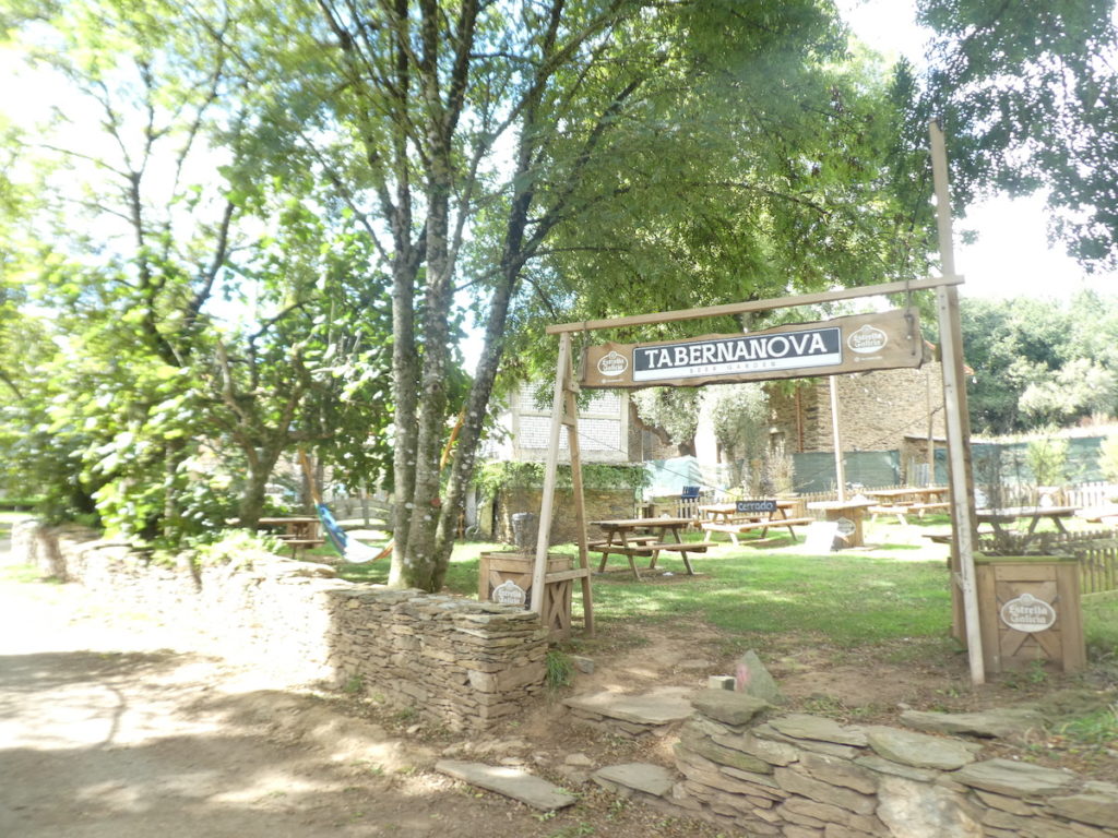
Shortly after, the pathway reaches a place called A Taberna Vella, where a bar nestles under the tall trees, perhaps closed.
| Here you are 33 km to Santiago. The Camino then takes a short stretch of road to head towards the Lugo-Santiago highway. |
 |
 |
| We did not see any passing vehicles. We cannot tell you the state of the work on this highway, which has been delayed, and which should be completed in 2024. |
 |
 |
| Shortly after crossing the highway, the Camino finds a side dirt road. |
 |
 |
| It runs through a large gravel driveway, almost under a real tunnel of shade under the chubby leafy trees that make you real guards of honor. |
 |
 |
| Shortly after, the pathway reaches the hamlet of La Calzada on the road. It is a peasant village, poor, with little infrastructure for pilgrims. The name A Calzada (meaning the road) refers to its location on the Roman and pilgrimage routes. It is the last hamlet of the municipality of Arzúa on the Camino francés. |
 |
 |
| The road skims the village and its carved stone houses, crosses a secondary road and runs again towards the woods. |
 |
 |
Here, the cabbages are almost real trees.

| The vegetation is quite lush on the slopes where weeds grow. Everything is green, suggesting the presence of frequent rains. The chestnut trees have recovered and are competing with the oaks. |
 |
 |
| Shortly after, the pathway runs along a hamlet that smells of cows and manure. |
 |
 |
| Further afield, the pathway begins to descend gently, almost imperceptibly. Sometimes, low walls raise the slopes. |
 |
 |
| You could stay for long minutes smelling the forest, standing motionless, listening to the docile trees sing their little refrain, in the middle of chestnut trees with crumpled stumps or eucalyptus, combed like at the hairdresser. |
 |
 |
| Further on, the pathway gradually emerges from the woods, along dry stonewalls. |
 |
 |
| It runs between two large walls where a few pilgrims’ trophies hang. There are sometimes animist overtones in them. |
 |
 |
| Soon the pathway gets in A Calle de Ferreiros. The hamlet of A Calle, which still means the street, is doubled as A Calle de Ferreiros (the street of the ironworkers). |
 |
 |
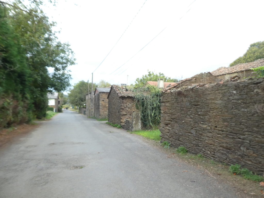
| A paved pathway crosses the winding lanes of the village, among the solid stone houses and the large hórreos, some of which look a little different from those previously encountered, more massive |
 |
 |
| At the end of the village, here is a bar that will not go unnoticed. |
 |
 |
| The Camino leaves the village and its slabs, and immediately a small pathway sinks into the lush vegetation. |
 |
 |
| A stone’s throw away, it crosses the Rego de Igrexario, a small stream lost in the weeds, near a new wooden hórreo. |
 |
 |
| Shortly after, it finds a small road which it crosses to pass through the adjacent hamlet of Lenguelle. |
 |
 |
Section 3: Dialogue with the national road.
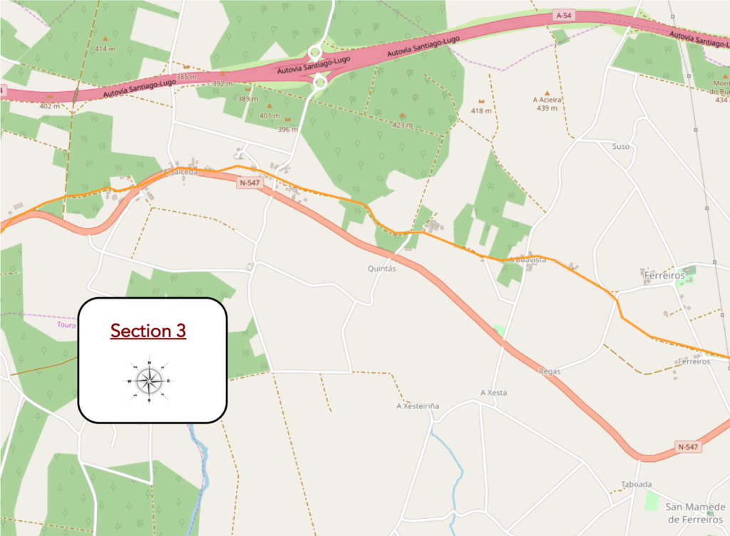
General overview of the difficulties of the route: course without great difficulty, but it is not flat.
| At the exit of the hamlet, a small piece of paved road awaits the pilgrim, but the Camino quickly takes the dirt road… |
 |
 |
| …along the low walls near the hamlet of Ferreiros, where the route does not pass. Farmers probably didn’t know what to do with the stones. So, they made flat stone hedges. Behind them, there is probably nothing valuable to hide. In fact, you hardly see any cattle in the meadows. |
 |
 |
| Here, the limestone outcrops, while Galicia is above all a granite country. Moreover, the low walls here are made of sandstone, shale and limestone. |
 |
 |
| It is then a wide pathway that sings in the leafy alleys. Here, the foot advances with pleasure, without effort. |
 |
 |
| Further on, at a crossroads near a cross, the Camino will take the tar for a few hundred meters… |
 |
 |
| …before finding a wide dirt road in the middle of the countryside. |
 |
 |
| The pathway then heads towards the village of A Boavista. There is a big difference in the architecture of the villages between Galicia and Castile. In Castile, houses most often line up on a single street. In Galicia, the villages are more scattered. And also, there are houses outside of villages, which is not the case in Castile. |
 |
 |
| A hórreo hides behind the trees at the entrance to the village. |
 |
 |
| Here, there is a way to eat and drink. |
 |
 |
The pilgrims will then cross another psychological barrier, that of the 30 km which separate them from Santiago.
| The pathway winds behind the few houses in the hamlet. |
 |
 |
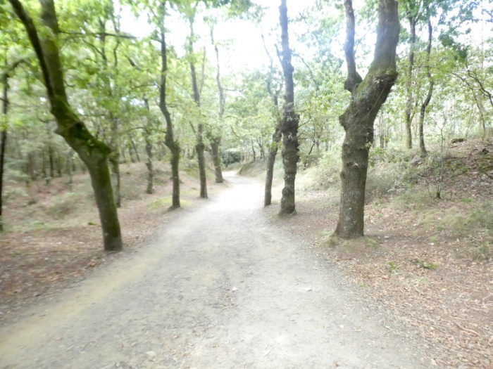
| So, it’s serenity again under the trees. You can cross the same forest a hundred times and you will find different noises, sounds and colors. Only the sea can compete in harmony with it. |
 |
 |
| PShortly after, at a place called Granxa de Dorindo, the pathway runs through an exotic site. It feels like somewhere in paradise or in the islands. Only the parrots are missing. . |
 |
 |
| Further on, the pathway crosses a side road and continues under the majestic trees. Little by little, the forests you roam become yours, not because you own them, but because they are engraved in you. |
 |
 |
 |
< |
| Further ahead, the pathway gets in O Castro. The bar is empty. Today we left two hours after the flow of pilgrims, to have great tranquility. Happiness, holidays, right? |
 |
 |
| The pathway crosses the hamlet. The stone houses are always solid, and the hórreos intriguing. Curiously, in this region, there is neither church nor chapel, omnipresent on the Camino francés. |
 |
 |
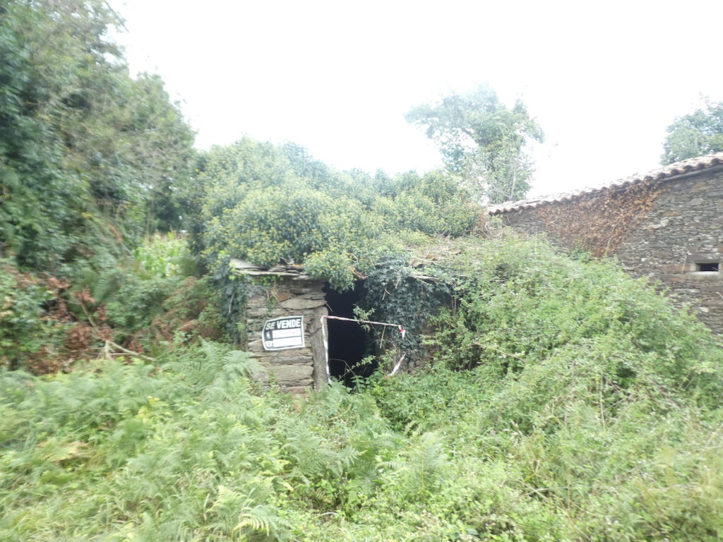
Some houses are just ruins. You can invest here.
| At the exit of the hamlet the pathway finds the abundant chlorophyll and goes to join the N-547, the main national road of the region. |
 |
 |
| The Camino then reaches A Salceda, at the side of the road. Here, some pilgrims will stop here or simply take a break. Cyclists will continue further. |
 |
 |
| The Camino runs along the road for a while. Here again, there are some ruins. |
 |
 |
| Here, the nice organizers of the Xunta de Galicia do not immediately take you on a new “Senda de los Peregrinos” of which they have the secret. They will make you wait in the woods. It’s generous of them. |
 |
 |
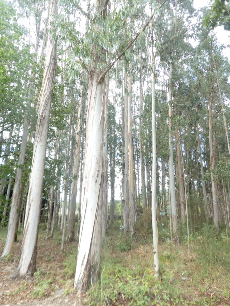
The eucalyptus raise their slender trunk bearing this smooth bark of a whitish green, which exfoliates just for the pleasure of the eyes.
| Shortly after, the pathway returns to the national road. |
 |
 |
| And as the country is vast, the organizers according to their desires or the morphology of the terrain can take their “Senda de los Peregrinos” to the side they want. You are still expecting the worst. You have been preparing for this for a long time. |
 |
 |
Section 4: Sometimes on the “senda de los peregrinos”.
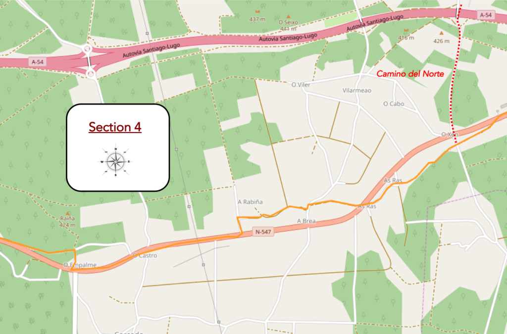
General overview of the difficulties of the route: course without great difficulty, but it is not flat.
| But here, we do not know for what reason, they managed to deviate the course of the road. All the same, after 1,000 km, we will not say that it is an exceptional performance. They could have done it all the way. Spain is so empty. Then, the pathway climbs through chestnut trees and oaks, away from the road. |
 |
 |
| And for our enjoyment, there are a few weather-aged hórreos to get under the ward. It is here that the Camion del Norte joins the Camino francés. Thus, from here, the Camino francés, the Camio primitivo and the Camino del Norte are only one and unique route. |
 |
 |
| We are at the beginning of autumn, and in Spain, the chestnuts begin to fall rapidly from the trees, 1 month earlier than in France or Switzerland. |
 |
 |
| Further up, the pathway arrives at the hamlet of As Ras, with some hórreos, some farms, some of which are made of odds and ends. |
 |
 |
| Shortly after, at the exit of the hamlet, the pathway crosses to the other side of the national road. It has to vary, right |
 |
 |
| Here, people have stoned the embankments with blocks of granite. |
 |
 |
| Quickly, the pathway gets in A Brea. Here too, the parasols have been folded. Pilgrims have already passed here for a long time. Innkeepers will reopen them the next day. |
 |
 |
| The village is rich in beautiful carved stone houses and hórreos, some of them rejuvenated. It must be said that in Galicia, the villages exude charm. You are very far from the poor houses of Castile, which hardly trigger enthusiasm. |
 |
 |
| At the exit of the hamlet, the pathway slopes down, crosses the Rego de Cerceda which you can hardly guess… |
 |
 |
| … to join the national road, with which you play leapfrog. |
 |
 |
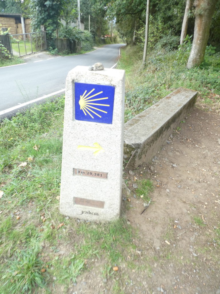
| You weren’t going to believe that you wouldn’t have the pleasure of taking a short trip on the « Senda de los Peregrinos », right? Here it is, 24 km to Santiago. |
 |
 |
| Traffic is derisory on the axis. The highway passes right next to it. And it is at the direction for the highway that the pathway leaves again on the other side of the road. |
 |
 |
| Shortly after, the pathway heads to a pleasant park where water flows from a historic fountain. |
 |
 |
| The “Senda de los Peregrinos” continues to climb, here with a little more slope. In the region, there are many houses in ruins. |
 |
 |
| At the top of the climb, the pathway arrives at a place called O Empalme, a large crossroads in fact, with two restaurants. |
 |
 |
| There is even a bus stop here, which says it all. So, the Camino leaves the axis for a short getaway in the forest. |
 |
 |
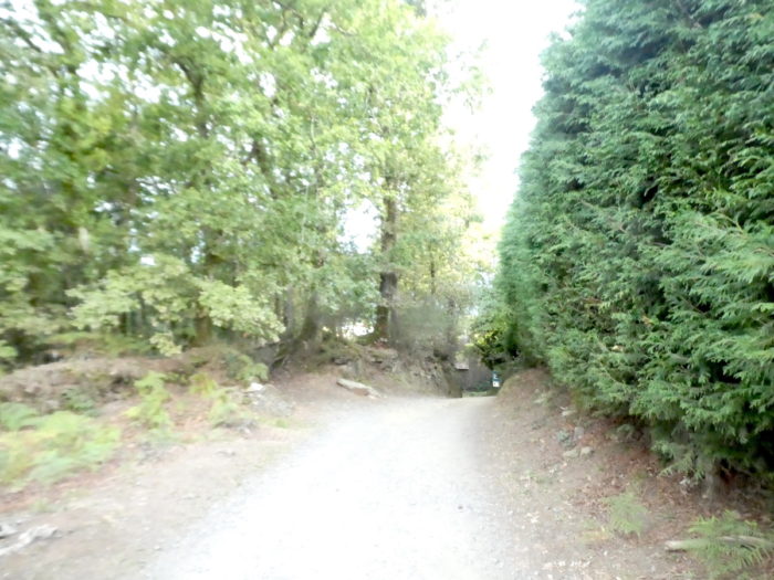
| The road trip is short and fast, it is a dirt road that descends steeply into the woods. |
 |
 |
| Further on, the oaks and chestnut trees create real shade tunnels. Even pines and eucalyptus are part of it. Further down, the pathway joins the national road. The getaway is over. |
 |
 |
Section 5: The course is fast approaching Santiago.
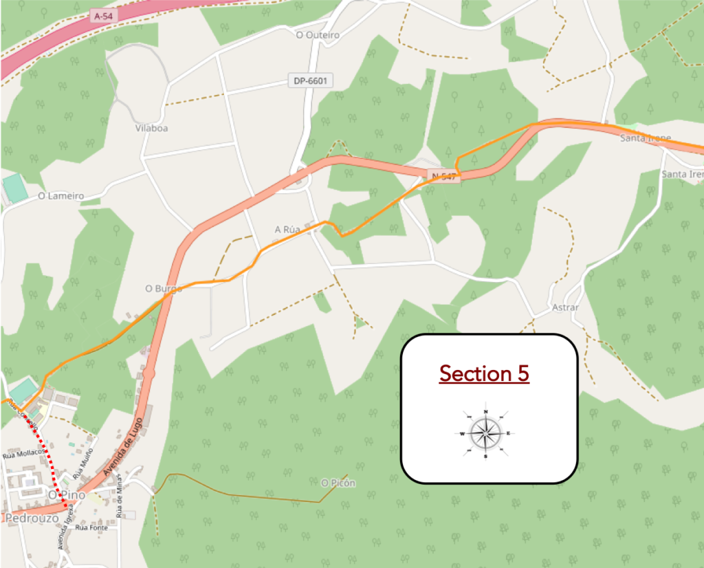
General overview of the difficulties of the route: a long descent all the same.
| The pathway then follows the N-547 road, before passing on the other side through a tunnel. |
 |
 |
| A paved pathway and then the road lead you to the hamlet of Santa Irene, which was once the seat of the neighboring municipality of O Pino. It bears the name of the nearby chapel of Santa Irene, from the end of the XVIIth century. Santa Irene was one of the first Christian martyrs, a young Portuguese nun who died here in the VIIth century defending her vow of chastity. |
 |
 |
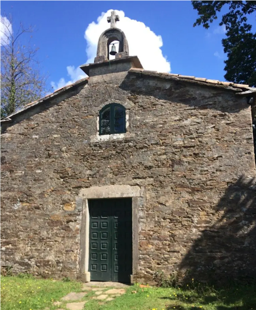
The chapel of Santa Irene is lost away from the hamlet in the oaks. In 1808, Napoleon’s troops, en route to Santiago, vandalized the site.
| Shortly after, the Camino returns to the national road and crosses again on the other side. |
 |
 |
| The fountain, Fuente de Santa Irene, previously contained a granite image of Santa Irene dating from 1692, which was stolen in the last century. This fountain is very popular with pilgrims, since it is called the Fonte da Xuventude Eternal (Fountain of Eternal Youth). According to legend, he who washes himself with its water will remain young forever. Right next to it stands a famous pilgrim refuge, the Refuxo de Peregrinos de Santa Irene. |
 |
 |
| Further on, the Camino returns to the “Senda de los Peregrinos” for a few hundred meters. The view opens to the south over the Río Ulla basin to the distant Pico Sacro, overlooking Santiago. |
 |
 |
| Shortly after, the Camino leaves the axis again to meander along the slender eucalyptus trees that scrape the sky. By planting the trees tightly against each other, they are encouraged to grow very quickly. You have to get the light up there. |
 |
 |
| Further on, the pathway returns again to the other side of the national road. |
 |
 |
| Then, the pathway gives way to a small road that descends towards the first houses of A Rúa… |
 |
 |
| …before finding down a pathway that slides under the trees. Here, people have planted young eucalyptus trees which are quite freluquets, we will put it that way. |
 |
 |
| Further down, the slope is steep to reach the village of A Rúa on the tarmac. |
 |
 |
| A Rúa, which means the street is an enclave of stone houses that still retain the charm of yesteryear. Its name derives from the linear composition of its main street. This contrasts with the radial layout of most rural Galician villages. |
 |
 |
Will these stone houses be refurbished one day to make them accommodation for pilgrims?
| Shortly after, the road arrives near the first lodgings of O Burgo, but you are still quite a distance from O Pedrouzo proper. |
 |
 |
| Right next to it there is a large campsite and a hórreo aged over the years. |
 |
 |
| The road continues to descend beyond the scattered houses of O Burgo. |
 |
 |
| At the bottom of the descent, the Camino crosses the Rego de Borgo stream in the eucalyptus trees. There, it joins and crosses the N-547 road again. |
 |
 |
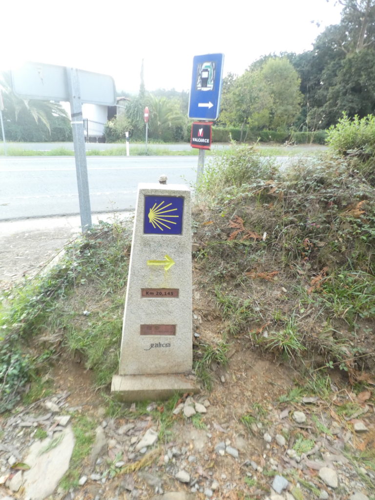
Here you are 20 km to Santiago. Pilgrims are already like horses smelling the stable.
| Beyond the intersection, a dirt road climbs again in the woods, on a fairly steep slope. Here, oaks, chestnuts and eucalyptus share the space. |
 |
 |
| This pathway, which is also called Rúa do Peregrino, arrives at the exit of the woods towards a semi-industrial complex. |
 |
 |
| Here the road winds around the block, passes the Luis Seoane Sociocultural Center. The latter was a lithographer and artist. Born in Buenos Aires, Argentina in 1910 to Galician immigrants, he spent much of his childhood and youth in Galicia. |
 |
 |
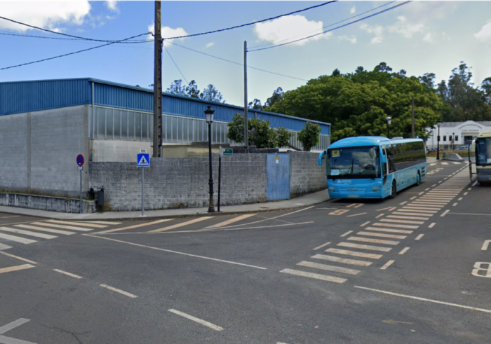
| Here you will often see buses, near a park. |
 |
 |
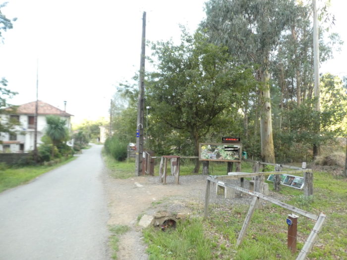
| So, to put it simply, O Pedrouzo is a place in the parish of Arca, in the municipality of Pino. All this little world brings together about 5,000 inhabitants. It gradually became a modern satellite city of Santiago. In recent years the area has become a popular last stop on the Camino before arriving in Santiago. The Camino remains in the wooded part of the town, but if you stop here, which is the rule, the accommodations are scattered throughout the region. |
 |
 |
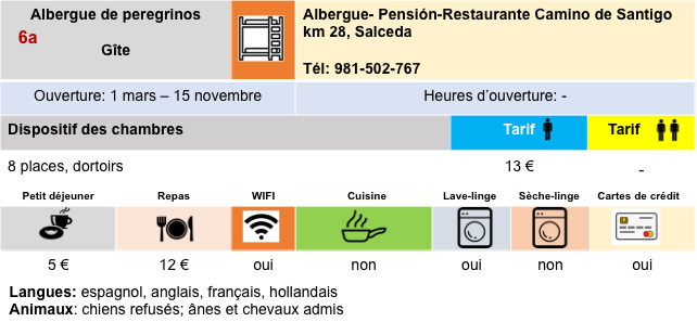
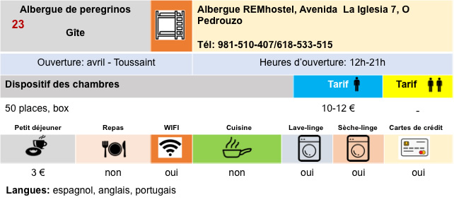
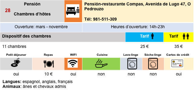
Logements